WALK 8 - THE KNOCK (FORT HILL NORTH OF LARGS)
The Knock is one of the most impressive ancient archaeological sites in Scotland, and although certainly not the highest hill, The Knock stands sentinel overlooking the north side of Largs. This is a small steep hill on top of a larger hill, with grooves and a causeway encircling the summit. However, there are no clearly marked tourist paths to the summit from Largs. The way to the top is via a farmhouse and via some tracks, and the walker even has to negotiate marshy moorland and clamber over fences on a short but challenging walk up the north side of the hill. This is worth climbing in moderate to good weather.
This is another loop walk, and the walker has a choice: start at Inverkip; or start at Wemyss Bay outside the train station and bus stop. This guide starts at Wemyss Bay.
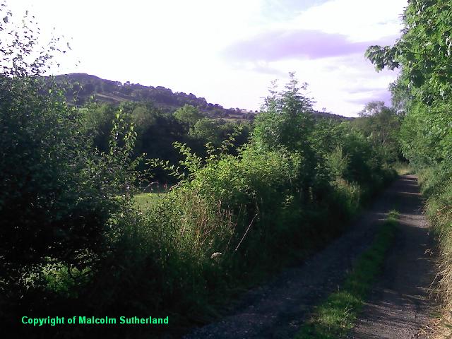
If you have alighted at Largs railway station or bus stop, walk north past the promenade, and keep walking along the A78 until you reach a junction with the episcopal church on the left side. The road on the right leads into Brisbane Glen and to Loch Thom, and is signposted. Walk along this road until you leave the housing estate and pass the cemetery. Beyond the cemetery there is no pavement, so watch out for farm vehicles and local traffic. There is a farmtrack on the left, about a few hundred yards along from the cemetery (Photo 1); this leads to the path to the top of The Knock.
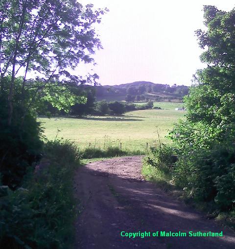
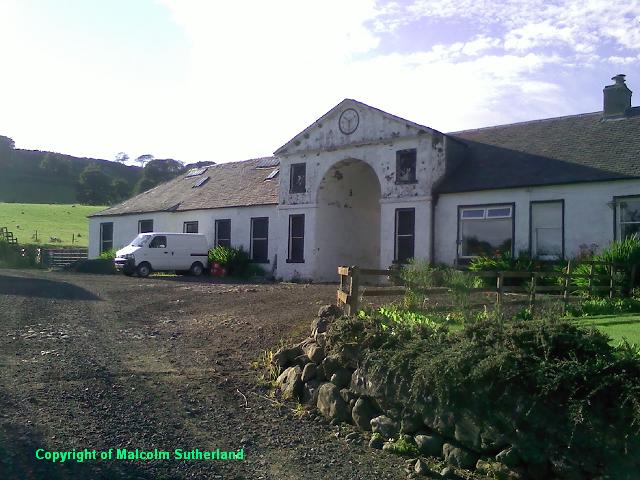
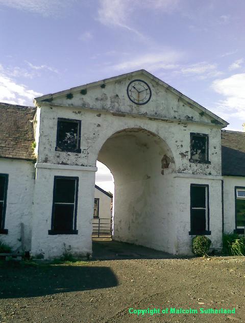
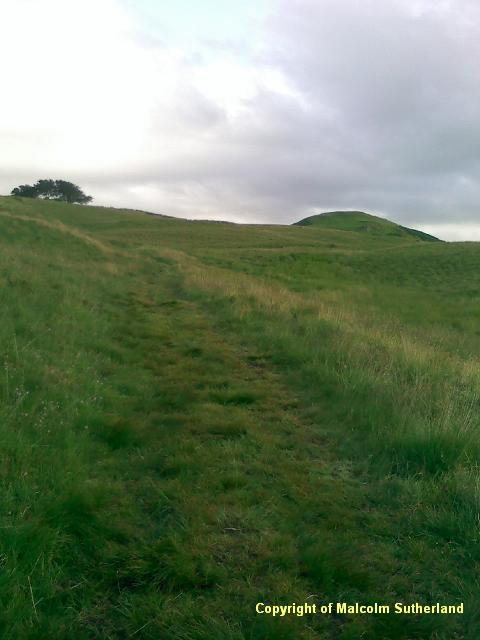
Follow the farm track, over the bridge (over the Noddsdale Water) (Photo 2), until you reach the entrance to the Brisbane Mains farmstead (Photo 3). This is fronted by an 18th century archway (Photo 4). Walk past the building, negotiate the stiles and walk past the barns and towards the grassy track (Photo 5). This track is good and there are splended views back to Largs (Photo 6). Further up the hill is a sheep dip (Photo 7): avoid this by following the track to the right. The path becomes less distinct and more grassy, and then splits; take the faintly marked left path towards the plateau (Photo 8).
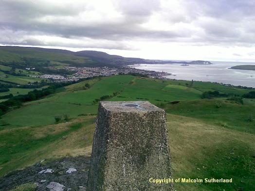
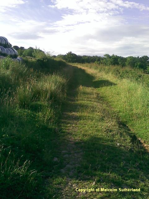
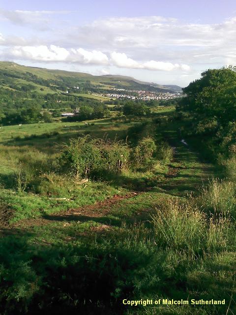
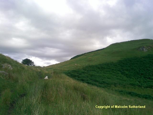
This track can be very marshy in places, even in mid-summer (Photo 9). After a few hundred yards, the track splits off to the left (from a faint track heading down towards some fields near the back road to Largs (another walk)). The path turns south and up towards the fort hill, from which the walker should be rewarded with views towards Bute and Argyll (Photo 10). The approach to the fort is generally grassy and marshy (Photos 11, 12). There follows a very short dip, and then a long circular ascent up the fort itself (Photo 13).
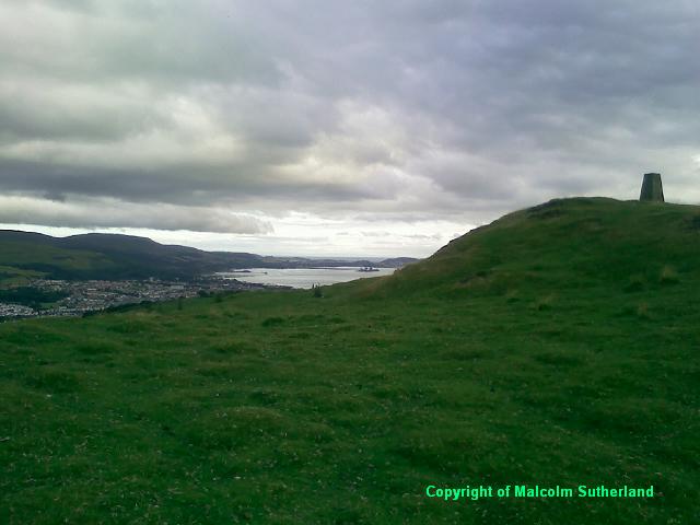
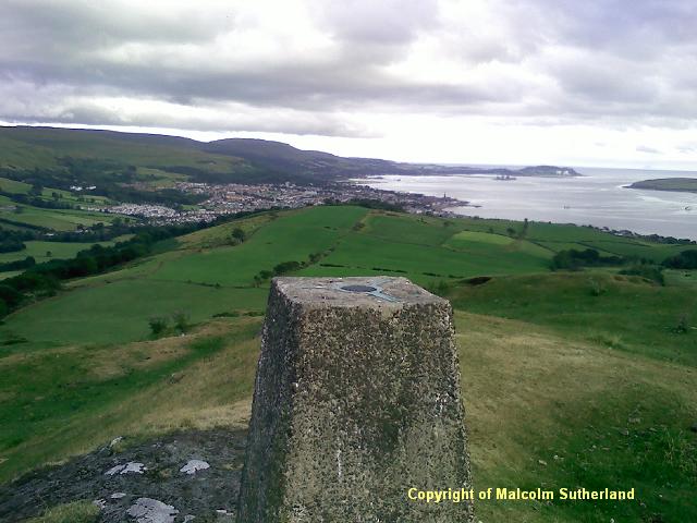
This hill has some of the best views of all the Muirshiel hills, mainly because this hill is not lost in amongst the hills on the Muirshiel plateau. Neighbouring hills, islands and towns which can be seen include:
If you have alighted at Largs railway station or bus stop, walk north past the promenade, and keep walking along the A78 until you reach a junction with the episcopal church on the left side. The road on the right leads into Brisbane Glen and to Loch Thom, and is signposted. Walk along this road until you leave the housing estate and pass the cemetery. Beyond the cemetery there is no pavement, so watch out for farm vehicles and local traffic. There is a farmtrack on the left, about a few hundred yards along from the cemetery (Photo 1); this leads to the path to the top of The Knock.
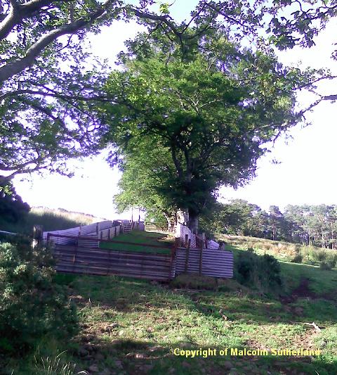
Follow the farm track, over the bridge (over the Noddsdale Water) (Photo 2), until you reach the entrance to the Brisbane Mains farmstead (Photo 3). This is fronted by an 18th century archway (Photo 4). Walk past the building, negotiate the stiles and walk past the barns and towards the grassy track (Photo 5). This track is good and there are splended views back to Largs (Photo 6). Further up the hill is a sheep dip (Photo 7): avoid this by following the track to the right. The path becomes less distinct and more grassy, and then splits; take the faintly marked left path towards the plateau (Photo 8).
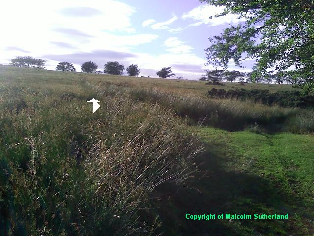
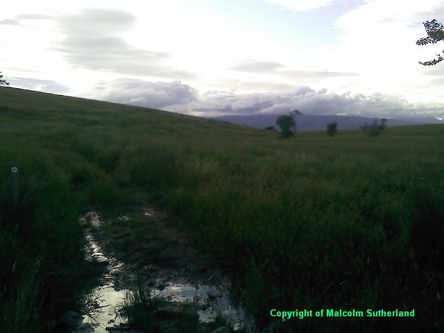
This track can be very marshy in places, even in mid-summer (Photo 9). After a few hundred yards, the track splits off to the left (from a faint track heading down towards some fields near the back road to Largs (another walk)). The path turns south and up towards the fort hill, from which the walker should be rewarded with views towards Bute and Argyll (Photo 10). The approach to the fort is generally grassy and marshy (Photos 11, 12). There follows a very short dip, and then a long circular ascent up the fort itself (Photo 13).
This hill has some of the best views of all the Muirshiel hills, mainly because this hill is not lost in amongst the hills on the Muirshiel plateau. Neighbouring hills, islands and towns which can be seen include:
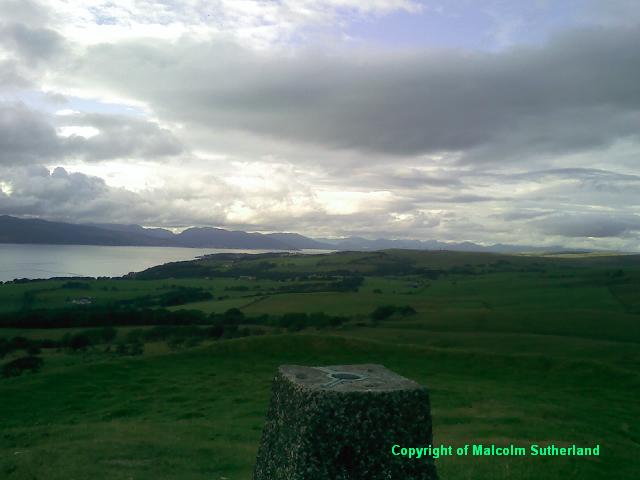
- Kames Hill and Gooseberry Hill, Fairlie and Largs (Photo 14);
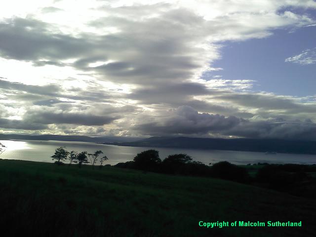
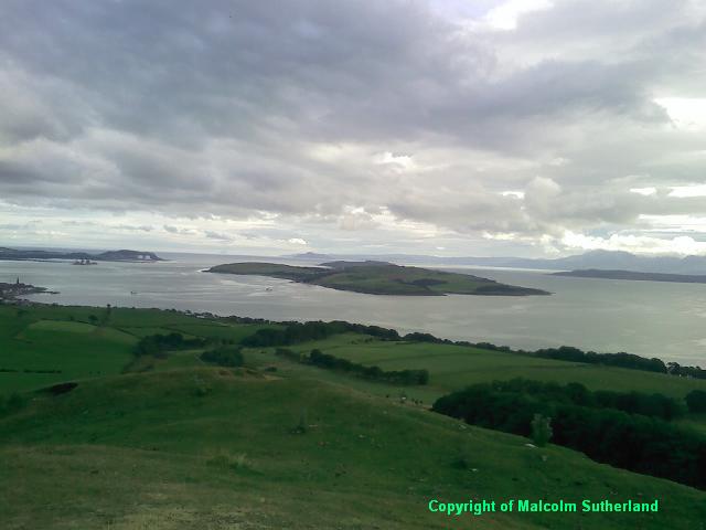
- Bute, Greater and Little Cumbrae, Arran and Holy Island, and the distant Ailsa Craig (Photo 15);
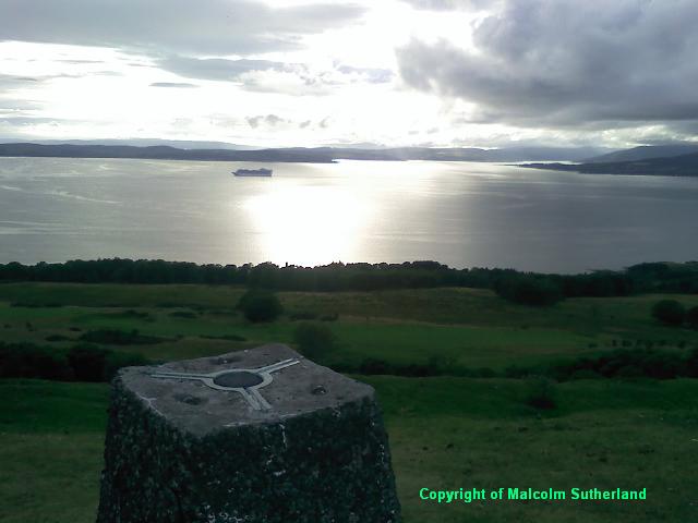
- Dunoon, the Argyll mountains and Glen Eck (Photo 16); and,
- the distant Kintyre Peninsula west of Bute (Photo 17).
All text, maps and imagery are copyright of Dr Malcolm Sutherland (2013 - 14).
DISCLAIMER: visitors to this website must take all necessary precautions when travelling to the sites listed in this website and when walking. People viewing this website are entirely responsible for their own transportation, health and safety if they travel to relevant locations and attempt any of the walks listed on this website.
DISCLAIMER: visitors to this website must take all necessary precautions when travelling to the sites listed in this website and when walking. People viewing this website are entirely responsible for their own transportation, health and safety if they travel to relevant locations and attempt any of the walks listed on this website.
