walk 12 - haylie brae - another largs walk
There are walks along both sides of the Gogo Glen behind Largs. What this walk lacks in distance, it certainly compensates with a sharp ascent of a very steep outcrop just outside the town's southern residential area. This is definitely a route for more athletic walkers who relish a short challenge after a long day in the office.
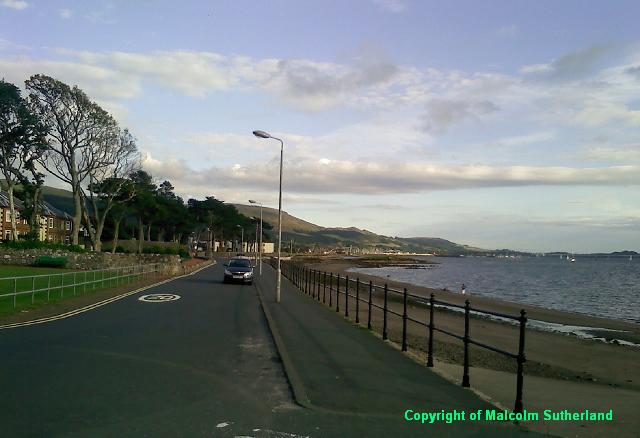
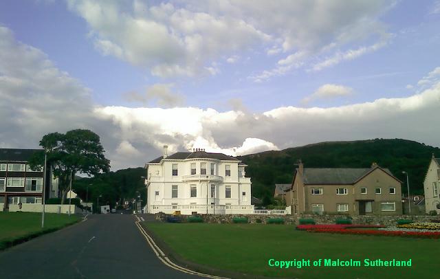
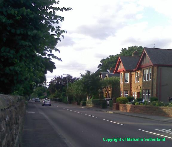
This route, along with many other walks in this series, takes the walker from town centre conurbation with its casually dressed locals, into untamed wilderness. You could walk from the bus stop or train station, along the Irvine Road (the A78) towards Douglas Park. This guide is for those who may want to park on Warrenpark Road (Photo 1). Walk up May Street past the white houses (Photo 2) until you reach Irvine Road (Photo 3). Be very careful when crossing this A road. Walk along towards Douglas Park, and walk the narrow tarmac road (which has many potholes) (Photo 4).
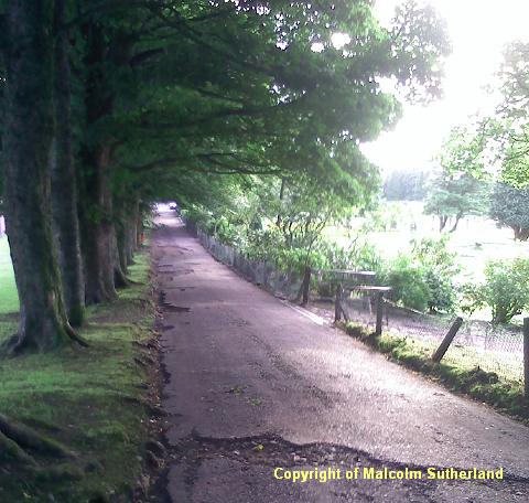
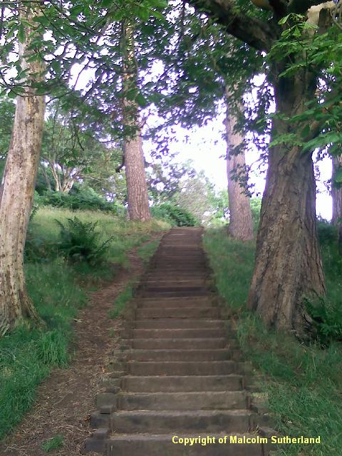
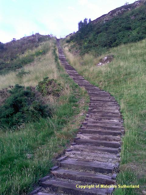
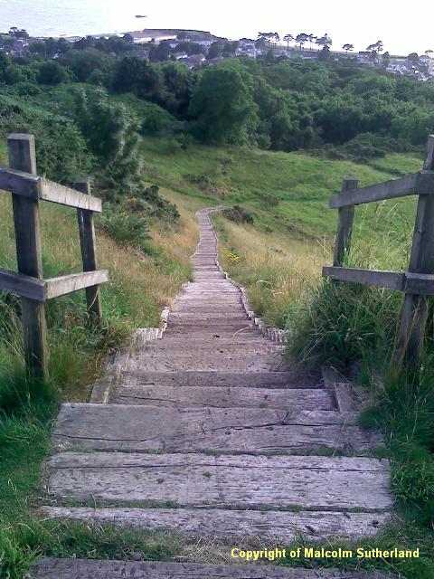
There is a path ahead, leading off the tarmac. Turn right and walk the path along the tennis courts and up the hill. This path soon becomes very steep - so steep in fact, that someone had the courtesy to use old railway sleepers to build a few stairways (e.g. Photo 5). After a couple of hundred yards, the path enters into a meadow and becomes a grassy track (Photo 6) which passes over a narrow back road to Castle Hill House. Shortly beyond the road to the house is the longest stairway (Photos 7, 8): this contains 210 steps. You could take this one step at a time, or two steps at a time; there is no easy way up.
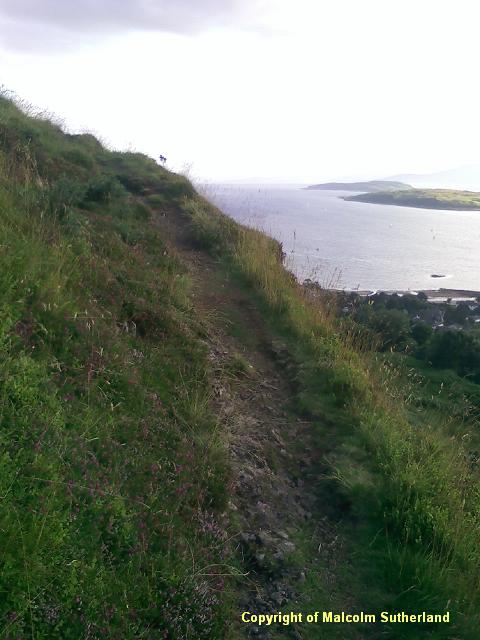
Above the stairway, there is a narrow track alongside the cliffedge, heading south (right) towards the viewpoints (Photo 9a). Do not take children along this path, and avoid it in winter. Another faint track goes around the back and towards the viewpoints. From here you can see the Haylie Brae road, a very steep hairpin road which bends at exactly 180 degrees (Photo 9b).
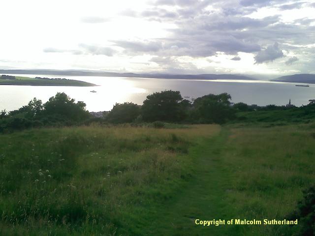
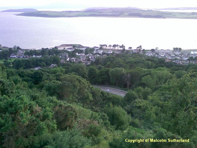
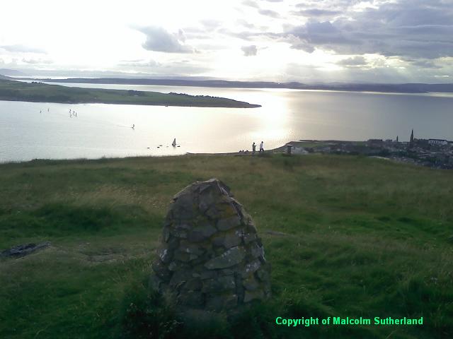
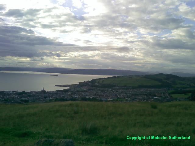
There are two viewpoints (Photo 10): the lower one is a metal monument, and the upper is a small cairn. The Knock (fort hill) and Argyll are visible to the north/northwest (Photo 11a); Cumbrae and Arran appear on the west (Photo 11b); and Gooseberry Hill and Kames Hill can be seen on the southern horizon (Photo 11c).
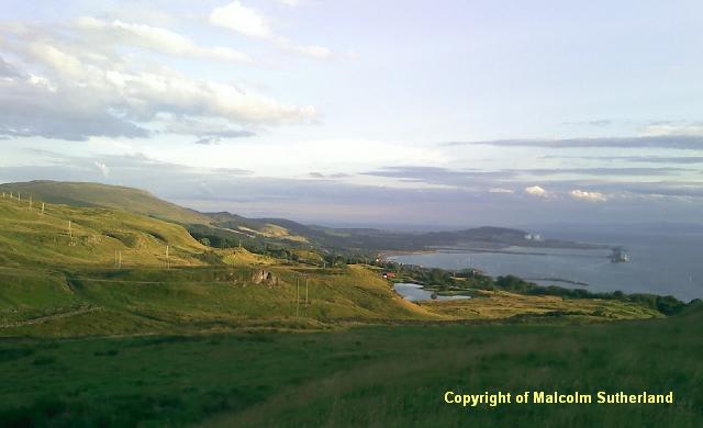
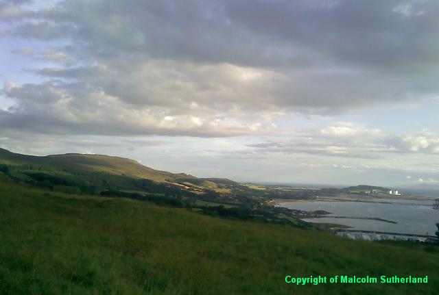
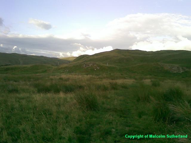
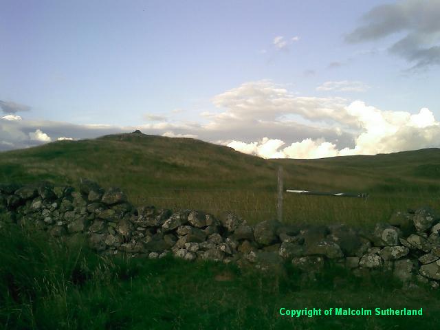
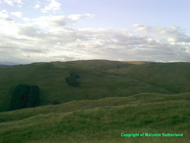
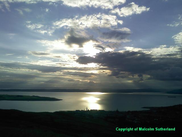
There is a vague grassy track leading east from the viewpoints into the moorland, and towards a more distant cairn about a kilometre away. It is not a good idea to walk this in poor visibility. The terrain is less steep (Photo 12), although there is a brief steep slope near the cairn. Near the cairn, the barbed wire fence is covered with a plastic tube (Photo 13). From this more distant cairn (on a good day), the walker is rewarded with views of the hills north of Gogo Glen (Photo 14a), and slightly more impressive views of the Firth of Clyde (Photo 14b).
There is a path ahead, leading off the tarmac. Turn right and walk the path along the tennis courts and up the hill. This path soon becomes very steep - so steep in fact, that someone had the courtesy to use old railway sleepers to build a few stairways (e.g. Photo 5). After a couple of hundred yards, the path enters into a meadow and becomes a grassy track (Photo 6) which passes over a narrow back road to Castle Hill House. Shortly beyond the road to the house is the longest stairway (Photos 7, 8): this contains 210 steps. You could take this one step at a time, or two steps at a time; there is no easy way up.
Above the stairway, there is a narrow track alongside the cliffedge, heading south (right) towards the viewpoints (Photo 9a). Do not take children along this path, and avoid it in winter. Another faint track goes around the back and towards the viewpoints. From here you can see the Haylie Brae road, a very steep hairpin road which bends at exactly 180 degrees (Photo 9b).
There are two viewpoints (Photo 10): the lower one is a metal monument, and the upper is a small cairn. The Knock (fort hill) and Argyll are visible to the north/northwest (Photo 11a); Cumbrae and Arran appear on the west (Photo 11b); and Gooseberry Hill and Kames Hill can be seen on the southern horizon (Photo 11c).
There is a vague grassy track leading east from the viewpoints into the moorland, and towards a more distant cairn about a kilometre away. It is not a good idea to walk this in poor visibility. The terrain is less steep (Photo 12), although there is a brief steep slope near the cairn. Near the cairn, the barbed wire fence is covered with a plastic tube (Photo 13). From this more distant cairn (on a good day), the walker is rewarded with views of the hills north of Gogo Glen (Photo 14a), and slightly more impressive views of the Firth of Clyde (Photo 14b).
All text, maps and imagery are copyright of Dr Malcolm Sutherland (2013 - 14).
DISCLAIMER: visitors to this website must take all necessary precautions when travelling to the sites listed in this website and when walking. People viewing this website are entirely responsible for their own transportation, health and safety if they travel to relevant locations and attempt any of the walks listed on this website.
DISCLAIMER: visitors to this website must take all necessary precautions when travelling to the sites listed in this website and when walking. People viewing this website are entirely responsible for their own transportation, health and safety if they travel to relevant locations and attempt any of the walks listed on this website.
