Walk 1 - WENCHLY TOP
This obscure hill near the Kelly Cut ditch is only a couple of miles outside Wemyss Bay, but it belongs in the remote wilderness. There is no trig point, no path leading to its summit, and no signposts. This isolated foothill commands an excellent view towards the Arygll mountains, and of Arran and Bute.
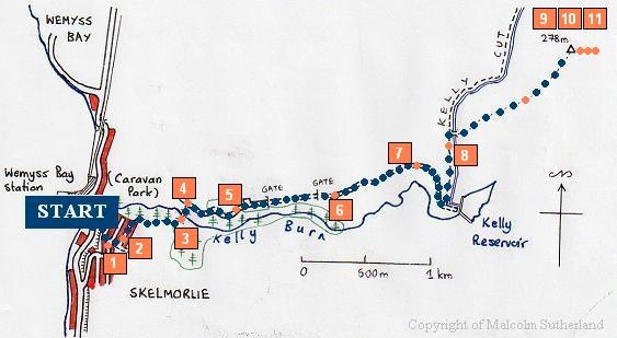
The reason why this hill is obscure will be obvious when you arrive at Wemyss Bay (or start out from Skelmorlie, in my case). It cannot be seen behind the great cliff and woodland looming above the railway station.
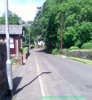
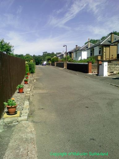
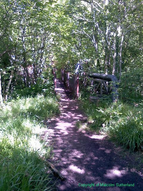
If you have alighted from the railway station or the bus stop (outside the station), you might be tempted to take a left turn into the caravan park and wander into the wood. This is not a good idea; the woodland walk degenerates into a mudslide, and is seriously eroded. Instead, cross over the bridge and take a sharp left up the steep Station Road (past the converted kirk). Take the second turning on the left (see Photo 1), and walk past Winton Drive towards Montgomerie Drive (see photo 2).
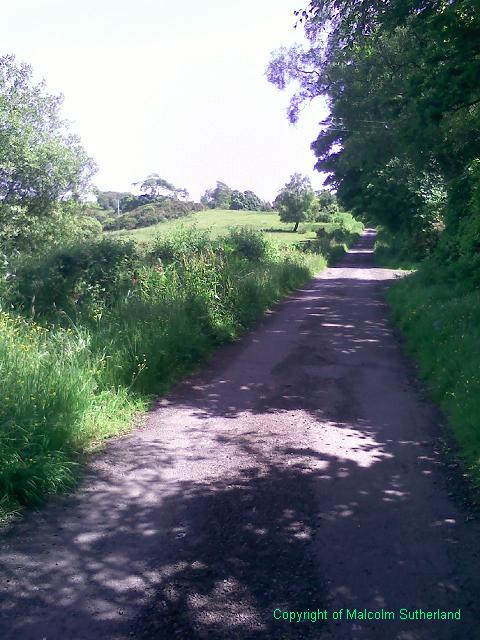
The start of the woodland path is very muddy and in a state of disrepair. It improves after about 100m, becoming a metalled path (this was once a drovers road). The path skirts past a meadow at the back of Skelmorlie, and then turns down a rocky, narrow trail towards a rickety bridge over the Kelly Burn (see Photo 3). The path past the bridge is rough underfoot, consisting of broken tarmac and loose stones, but it soon joins with the road leading out of the caravan park. Turn right and head up the hill (Photo 4).
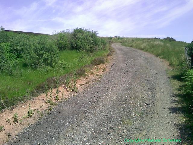
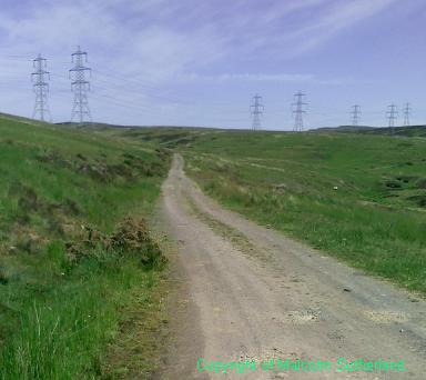
After about half a mile up a moderately steep slope, you should approach a small terrace of houses and a turning point on the road. Pass the houses and negotiate the gate at the end of the road. The tarmac ends and the metalled road begins. There is another gate a few hundred yards ahead; you can heave the gate off the ground slightly and push back the lock. The road then becomes steep again as you enter into the moorland (Photo 6) and approach the turn-off for the reservoir and the Kelly Cut (canal and path) (Photo 7).
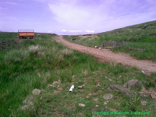
Follow the Kelly Cut path for a few hundred yards. There is no marked path to the Wenchly Top summit, but there is a small bridge over the Kelly Cut canal beside a trough for cattle (Photo 8). (! If you see any bulls around the path, veer off the path or turn back !)
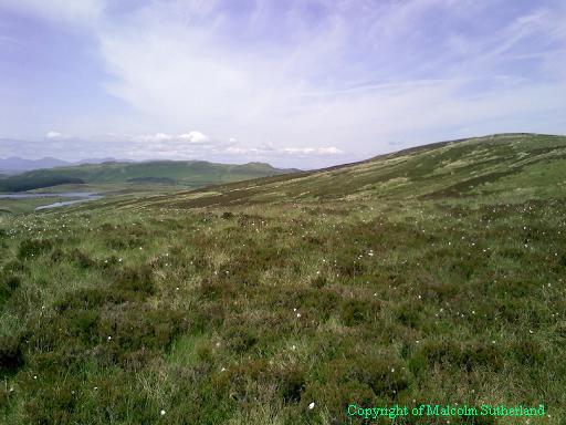
The last climb up the hill is rough underfoot and takes patience (see photo at top of this page). There are several small false summits. The distance is around 1km, so imagine that you are clambering through moss, thistle, heather and across those bumpy "tufts" along ten 100m racetracks.
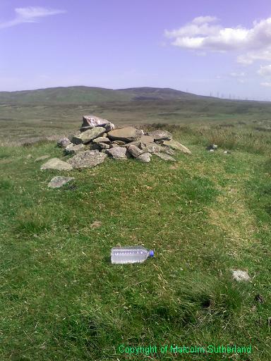
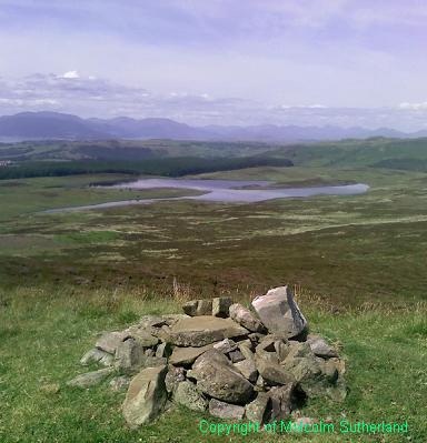
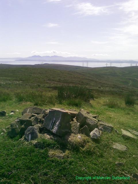
The summit consists merely of short grass and a small pile of rocks. However, on a good day, the views are spectacular, with a reasonable view to the back hills near Port Glasgow (Photo 9); a northern prospect of the Arrochar Alps (including the Cobbler) (Photo 10); and views to the south of Bute and Arran (Photo 11).
If you have alighted from the railway station or the bus stop (outside the station), you might be tempted to take a left turn into the caravan park and wander into the wood. This is not a good idea; the woodland walk degenerates into a mudslide, and is seriously eroded. Instead, cross over the bridge and take a sharp left up the steep Station Road (past the converted kirk). Take the second turning on the left (see Photo 1), and walk past Winton Drive towards Montgomerie Drive (see photo 2).
The start of the woodland path is very muddy and in a state of disrepair. It improves after about 100m, becoming a metalled path (this was once a drovers road). The path skirts past a meadow at the back of Skelmorlie, and then turns down a rocky, narrow trail towards a rickety bridge over the Kelly Burn (see Photo 3). The path past the bridge is rough underfoot, consisting of broken tarmac and loose stones, but it soon joins with the road leading out of the caravan park. Turn right and head up the hill (Photo 4).
After about half a mile up a moderately steep slope, you should approach a small terrace of houses and a turning point on the road. Pass the houses and negotiate the gate at the end of the road. The tarmac ends and the metalled road begins. There is another gate a few hundred yards ahead; you can heave the gate off the ground slightly and push back the lock. The road then becomes steep again as you enter into the moorland (Photo 6) and approach the turn-off for the reservoir and the Kelly Cut (canal and path) (Photo 7).
Follow the Kelly Cut path for a few hundred yards. There is no marked path to the Wenchly Top summit, but there is a small bridge over the Kelly Cut canal beside a trough for cattle (Photo 8). (! If you see any bulls around the path, veer off the path or turn back !)
The last climb up the hill is rough underfoot and takes patience (see photo at top of this page). There are several small false summits. The distance is around 1km, so imagine that you are clambering through moss, thistle, heather and across those bumpy "tufts" along ten 100m racetracks.
The summit consists merely of short grass and a small pile of rocks. However, on a good day, the views are spectacular, with a reasonable view to the back hills near Port Glasgow (Photo 9); a northern prospect of the Arrochar Alps (including the Cobbler) (Photo 10); and views to the south of Bute and Arran (Photo 11).
All text, maps and imagery are copyright of Dr Malcolm Sutherland (2013 - 14).
DISCLAIMER: visitors to this website must take all necessary precautions when travelling to the sites listed in this website and when walking. People viewing this website are entirely responsible for their own transportation, health and safety if they travel to relevant locations and attempt any of the walks listed on this website.
DISCLAIMER: visitors to this website must take all necessary precautions when travelling to the sites listed in this website and when walking. People viewing this website are entirely responsible for their own transportation, health and safety if they travel to relevant locations and attempt any of the walks listed on this website.
