Walk 19 - glen eck (puck's glen walk)
This is one of the shortest but toughest of the walks described on this website. This epic crawl up a steep ravine through Scandinavian woodland will challenge even the most feral hillwalkers. This is certainly not a stroll through suburbia, and walkers are strongly advised to wear gaiters and hillwalking boots, use a stick, carry a map, and always be prepared for a sudden change in the weather. Glen Eck is one of the wettest places on Earth - it rains for at least an hour or two almost every single day of the year. Should you be fortunate enough to enter Glen Eck on those rare sunny days, the panorama at the foothill just outside the Puck Glen woodland is worth the physical effort.
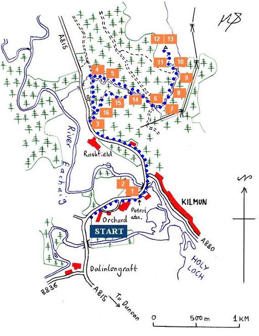
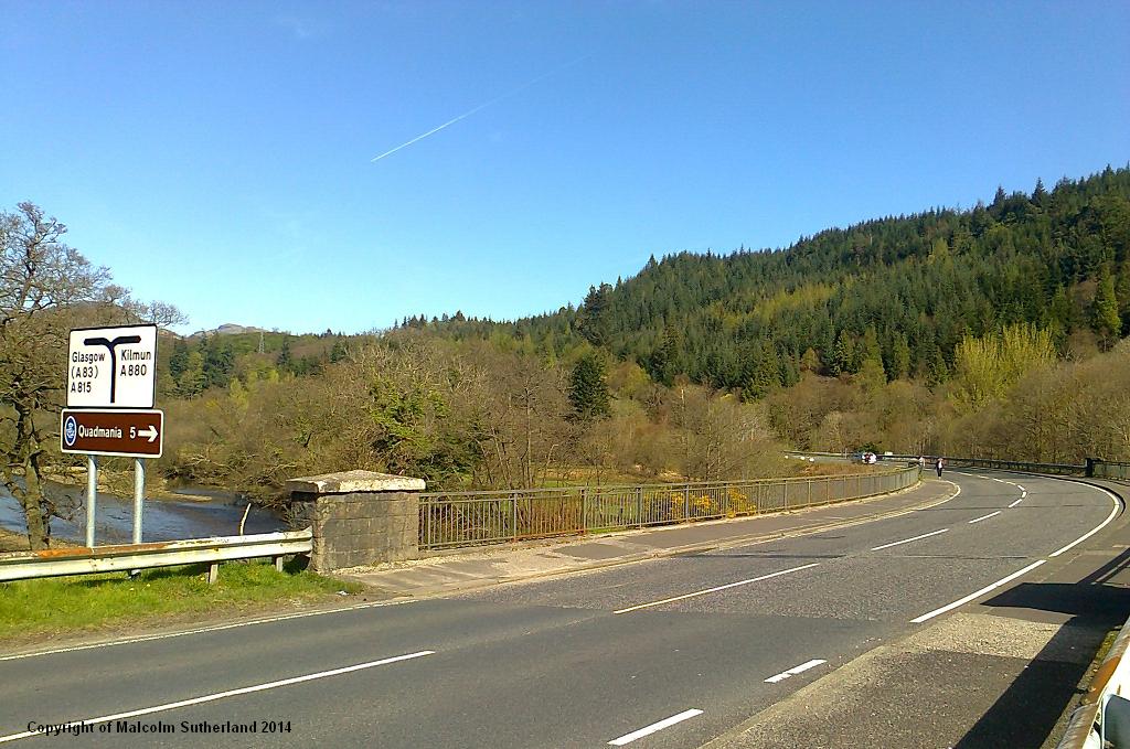
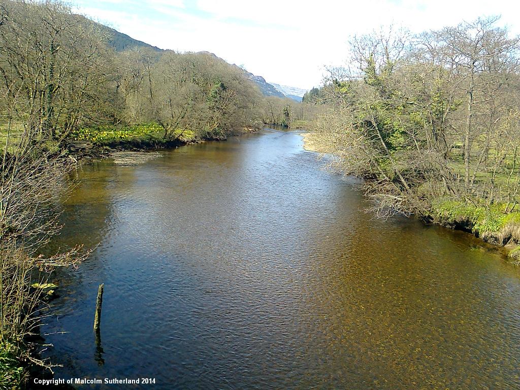
If you are using public transport, take the bus to Kilmun Turn, a lonely bus stop where the road bends to the right after the bridge, after the B836 turnoff. There is a pavement from there until you reach the bridge over the Eachaig river (photos 1, 2).
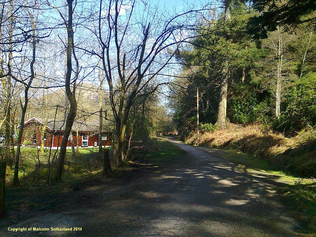
Once you cross over the Ardentinny road, the pavement disappears. Walk on the wide grass verge on the right hand side of the A815 and keep on going until you reach the Puck Glen chalets. Pass the small car park and follow the old Glen Eck road (photo 3) for around 400 yards until you reach the start of the Puck Glen path. (There are two Puck Glen tracks, one of which emerges at the car park. In this version, the walker starts on the slightly more northerly path, which criss-crosses the burn.)
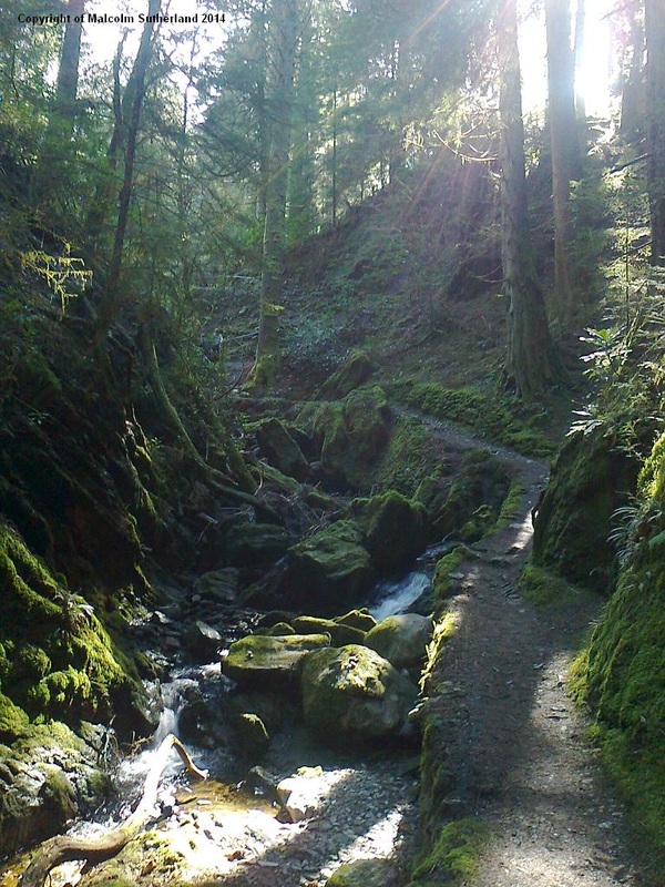
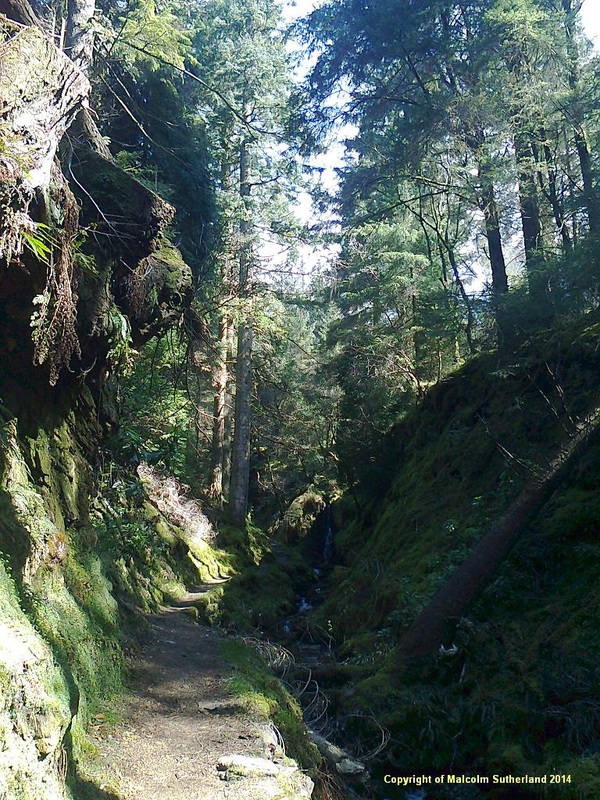
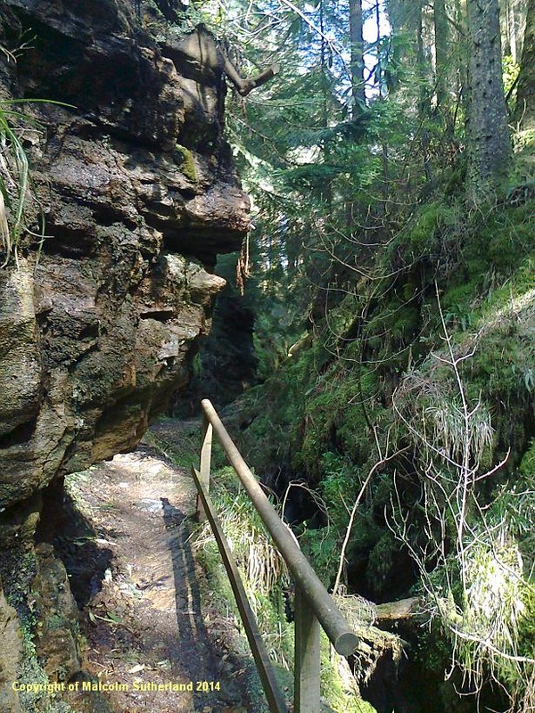
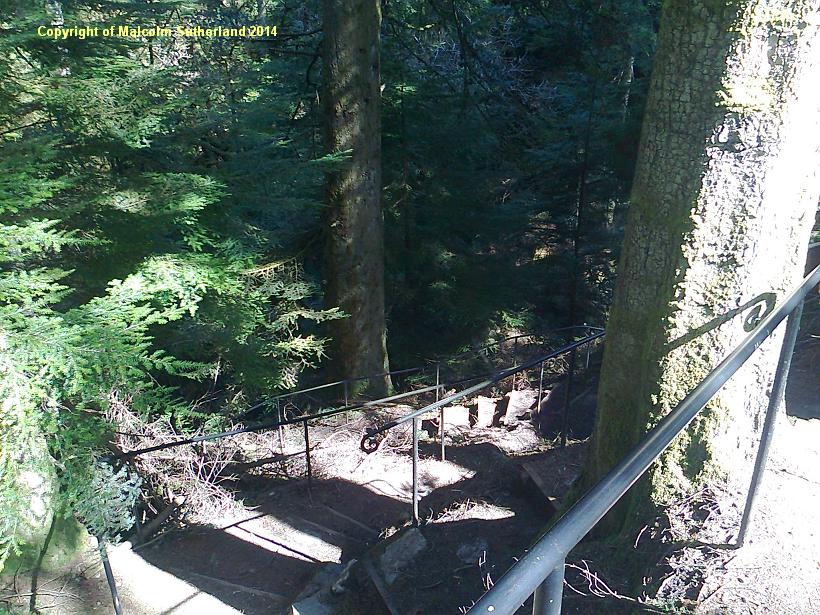
Immediately the path starts a persistent and epic climb up the narrow and precipitous river gorge. Much effort has been taken by the regional park authority to make this river gorge walk relatively safe. Several wooden ledges, bridges and handrails have been painstakingly erected. The path has been metalled and is supported by stone embankments (photo 4). Even so, the walker should ascend this path with caution, as there are some very slippery stone-cut steps, and low overhanging rock faces (photo 5). NB: halfway up this first section is a path to the right - which is the other Puck Glen path leading back to the car park.
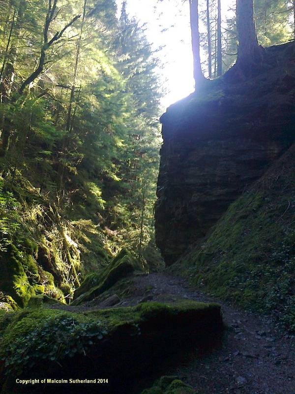
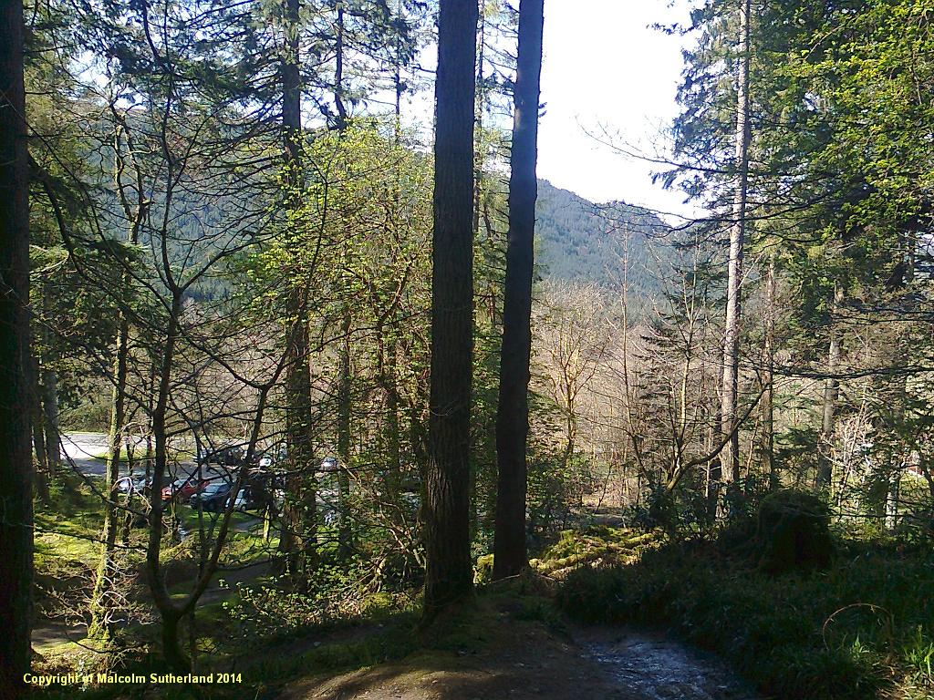
The merged Puck Glen path later emerges into an opening in the woodland, and crosses over a wide metalled road (photo 6). Carry on further up the Puck Glen path and keep following the river gorge. At first the path is a gradual and fairly safe ascent (photo 7). However, the gradient becomes tougher, and the path becomes more dramatic, with some low outcrops jutting out (photo 8). The top of the gorge is marked by a very steep, slippery set of stone steps (hewn out of the rock) (photo 9). A walking stick (perhaps two) is vital. This should not be attempted during heavy rain, frost or snow.
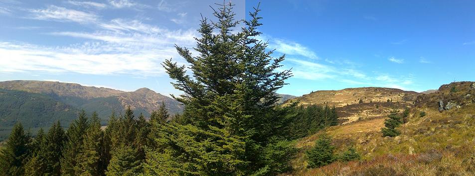
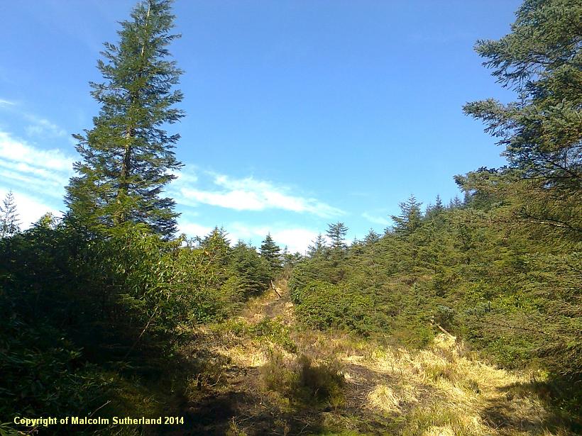
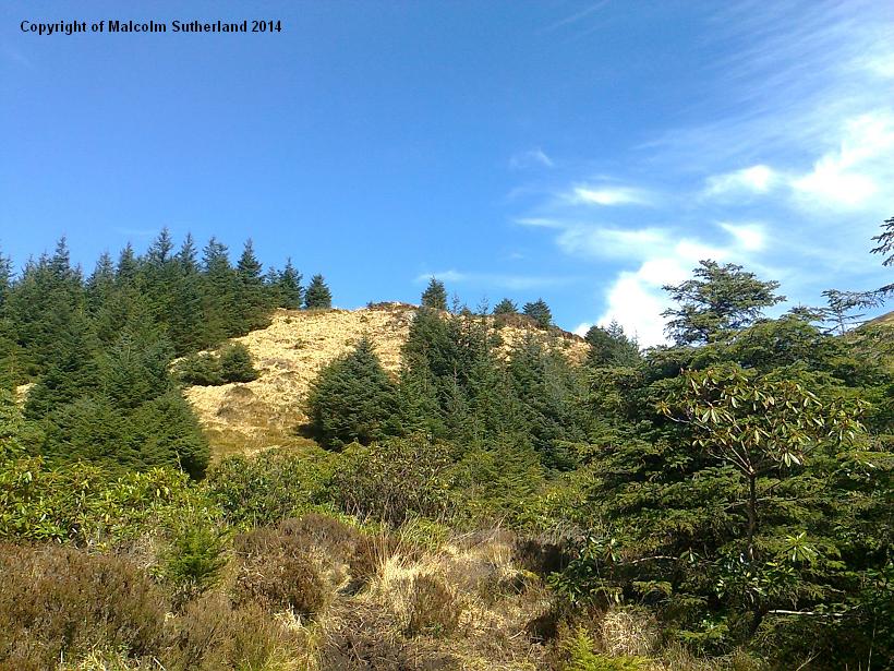
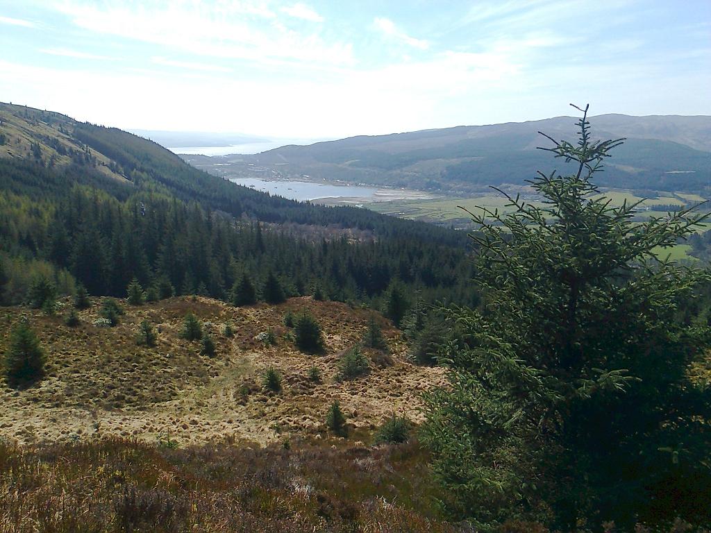
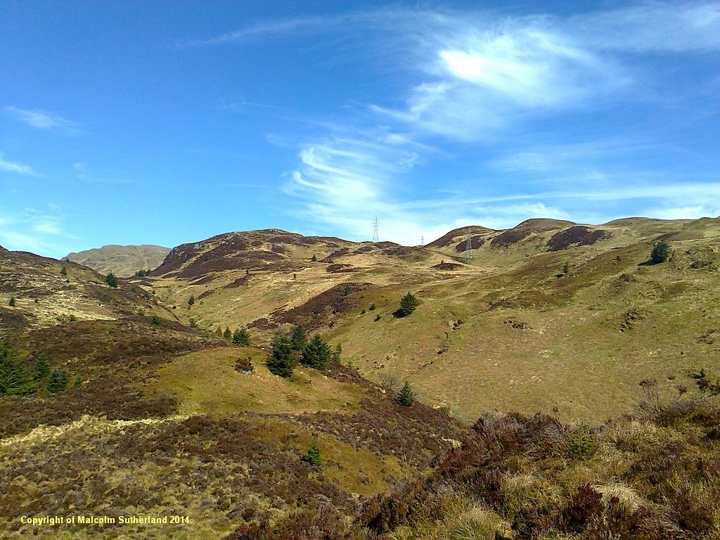
At the end of the woodland, there is a path taking a sharp turn to the left, which leads eventually to the Benmore Garden Centre. However, this walk carries on straight ahead and upwards, into very steep grassland (photo 10). The path is very muddy, but initially the ascent is reasonable. However, there is a very steep climb up long tufted grass to a round, partly forested foothill (photo 11). Take care when climbing this hill. The views from the summit are worth both the physical effort and the precautions: provided the weather behaves itself, the walker (or rather, climber) is rewarded with views across the Holy Loch, Dunoon and down the Clyde (photo 12); and north towards the craggy plateau in front of Beinn Ruadh (photo 13).
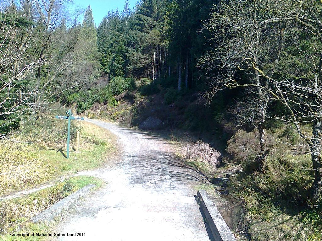
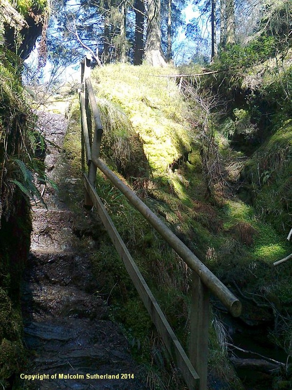
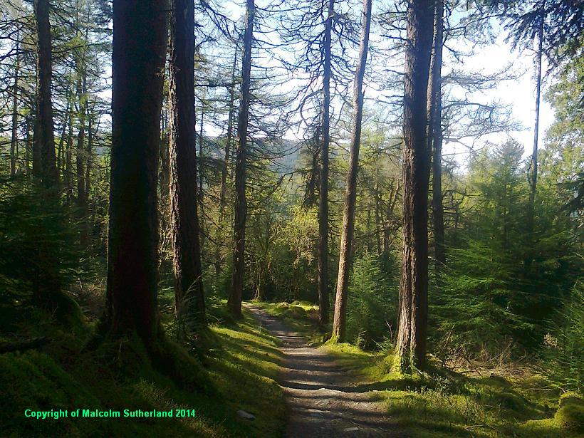
Descending from this foothill is even tougher, and must be completed using walking sticks. Walkers must also proceed with care when returning to the Puck Glen woodland and pathway. Go back down the ravine, cross over the metalled road, and carry on downstream until you see the path splitting off to the left. This is impossible to miss, as the path starts along a multi-terraced stairway with large black handrails (photo 14). Following this short and steep ascent, the path levels off and proceeds gently downhill through a more verdant landscape (photo 15). As usual the path meanders, twists and bends its way down the contours. After a sharp bend, the path approaches the car park (photo 16).
Once you cross over the Ardentinny road, the pavement disappears. Walk on the wide grass verge on the right hand side of the A815 and keep on going until you reach the Puck Glen chalets. Pass the small car park and follow the old Glen Eck road (photo 3) for around 400 yards until you reach the start of the Puck Glen path. (There are two Puck Glen tracks, one of which emerges at the car park. In this version, the walker starts on the slightly more northerly path, which criss-crosses the burn.)
Immediately the path starts a persistent and epic climb up the narrow and precipitous river gorge. Much effort has been taken by the regional park authority to make this river gorge walk relatively safe. Several wooden ledges, bridges and handrails have been painstakingly erected. The path has been metalled and is supported by stone embankments (photo 4). Even so, the walker should ascend this path with caution, as there are some very slippery stone-cut steps, and low overhanging rock faces (photo 5). NB: halfway up this first section is a path to the right - which is the other Puck Glen path leading back to the car park.
The merged Puck Glen path later emerges into an opening in the woodland, and crosses over a wide metalled road (photo 6). Carry on further up the Puck Glen path and keep following the river gorge. At first the path is a gradual and fairly safe ascent (photo 7). However, the gradient becomes tougher, and the path becomes more dramatic, with some low outcrops jutting out (photo 8). The top of the gorge is marked by a very steep, slippery set of stone steps (hewn out of the rock) (photo 9). A walking stick (perhaps two) is vital. This should not be attempted during heavy rain, frost or snow.
At the end of the woodland, there is a path taking a sharp turn to the left, which leads eventually to the Benmore Garden Centre. However, this walk carries on straight ahead and upwards, into very steep grassland (photo 10). The path is very muddy, but initially the ascent is reasonable. However, there is a very steep climb up long tufted grass to a round, partly forested foothill (photo 11). Take care when climbing this hill. The views from the summit are worth both the physical effort and the precautions: provided the weather behaves itself, the walker (or rather, climber) is rewarded with views across the Holy Loch, Dunoon and down the Clyde (photo 12); and north towards the craggy plateau in front of Beinn Ruadh (photo 13).
Descending from this foothill is even tougher, and must be completed using walking sticks. Walkers must also proceed with care when returning to the Puck Glen woodland and pathway. Go back down the ravine, cross over the metalled road, and carry on downstream until you see the path splitting off to the left. This is impossible to miss, as the path starts along a multi-terraced stairway with large black handrails (photo 14). Following this short and steep ascent, the path levels off and proceeds gently downhill through a more verdant landscape (photo 15). As usual the path meanders, twists and bends its way down the contours. After a sharp bend, the path approaches the car park (photo 16).
All text, maps and imagery are copyright of Dr Malcolm Sutherland (2013 - 14).
DISCLAIMER: visitors to this website must take all necessary precautions when travelling to the sites listed in this website and when walking. People viewing this website are entirely responsible for their own transportation, health and safety if they travel to relevant locations and attempt any of the walks listed on this website.
DISCLAIMER: visitors to this website must take all necessary precautions when travelling to the sites listed in this website and when walking. People viewing this website are entirely responsible for their own transportation, health and safety if they travel to relevant locations and attempt any of the walks listed on this website.
