walk 21 - kilpatrick hills
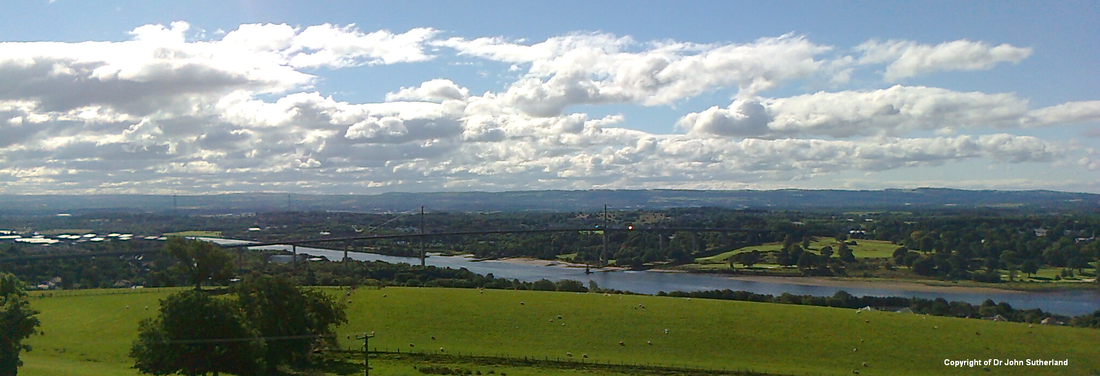
If Ben Lomand is 'Glasgow's mountain', then The Kilpatrick Hills surely deserves recognition as the best foothills on the outskirts of the metropolis. These form a magnificent rocky redoubt that overshadows Old Kilpatrick, and that is partly answered by the architectural hulk of the Erskine Bridge. This walk follows the very steep metalled road from a farm just outside Old Kilpatrick up and around the escarpment, which then becomes a more gentle ascent towards Loch Humphrey (an artifical lake). A rough path carries on across the plateau to some of the small hill tops in the centre of the Kilpatrick Hills, with views towards the Campsies and the Grampian Mountains.
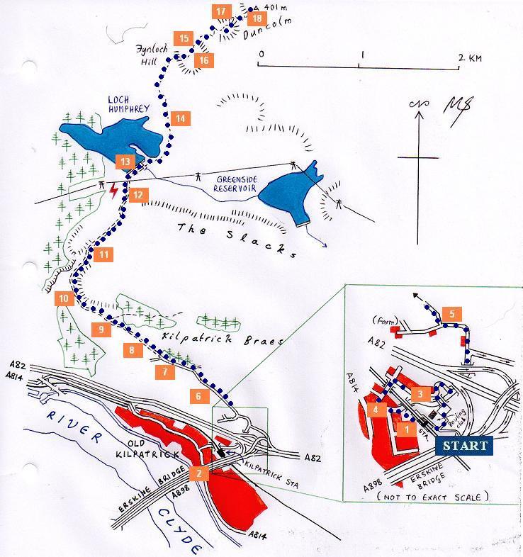
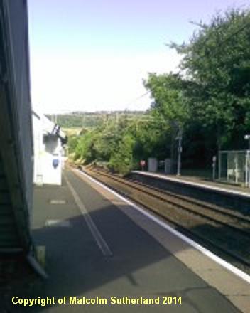
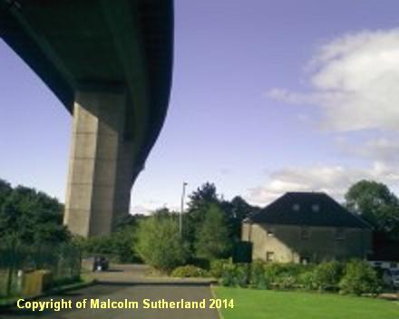
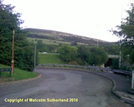
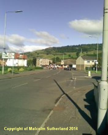
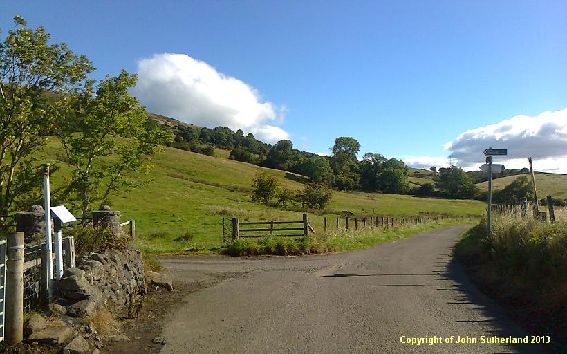
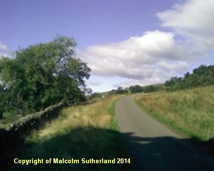
Old Kilpatrick is easily accessible by train and bus. If you arrive by train (photo 1), cross over the railway bridge and walk past the bowling green and the car park. Cross over the small road bridge, turn right and follow the short, sharply bending road (photo 3) towards the road passing underneath the A82 dual carriageway. Carry on along this road until you reach the narrow farm road. Keep on walking until you reach the junction (photo 5); take the road to the right and proceed up the hill. If you have taken a bus and have alighted in the centre of the town (i.e. underneath the Erskine Bridge (photo 2), approach the first main road turning off to the right from the old Dumbarton Road (photo 4). Keep following the road until you reach the A82 dual carriageway underpass.
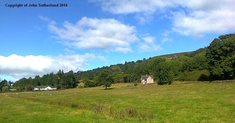
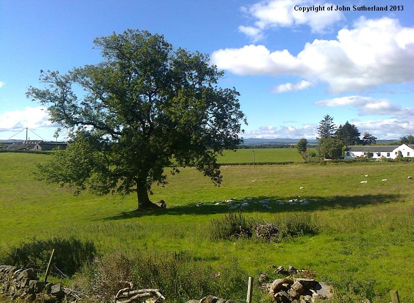
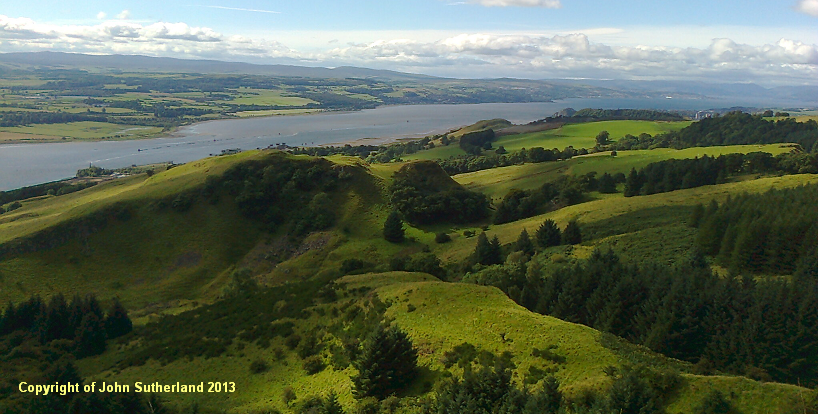
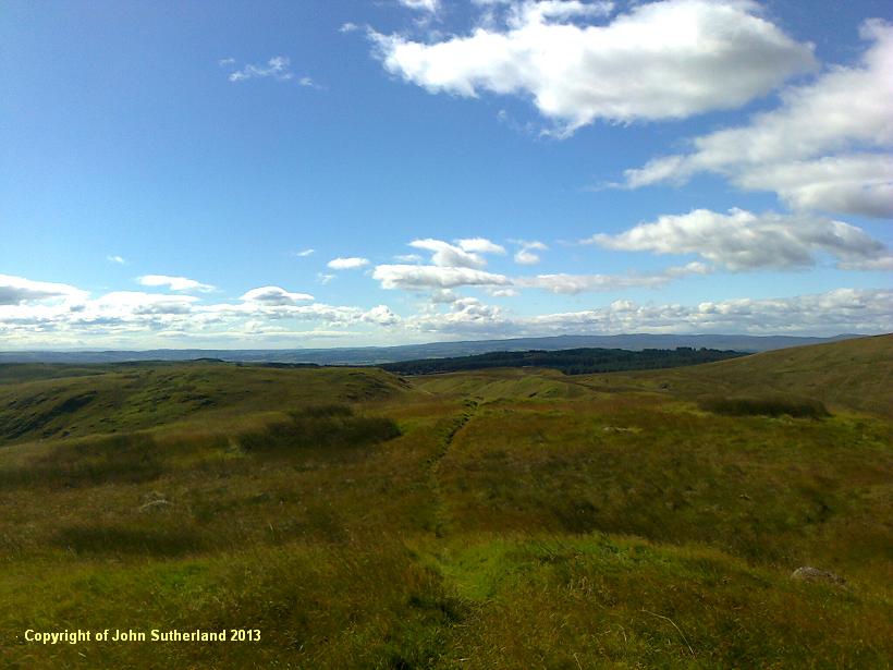
Once you have reached the junction and taken a right turn (photo 5), follow the farm track, which passes through some pastoral land and the occasional cottage (photos 6, 7). In time the road becomes much steeper and begins its circuitous ascent of the Kilpatrick Hills (photo 8). Further up the climb, the tarmac disappears and the road is metalled. The views south and east are spectacular (unless it happens to be raining), with the prominent Esrkine Bridge (photo 9), the wide sprawl of Glasgow in the distance, and even a sighting of Hamilton and Motherwell in the far horizon. To the west, the foothills are steep and almost hemispherical, and dotted with trees; Greenock and Dumbarton can be seen further down the Clyde (photo 10).
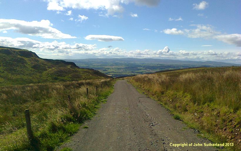
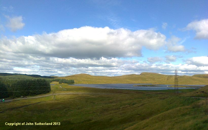
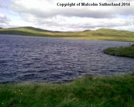
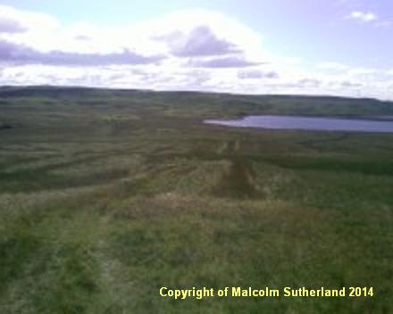
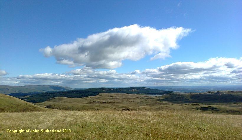
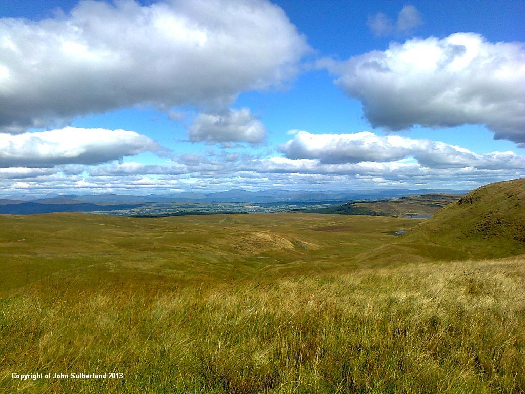
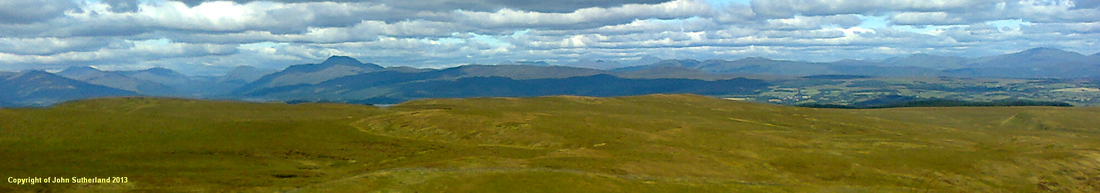
The road continues to curve to the right until it passes over a cliffedge, and turns north onto the plateau (photo 11). The contours ease and the path becomes a gentle stroll towards Loch Humphrey (photos 12, 13). The metalled road ends at the front of the loch. A rough trail carries on around the east side of the loch (photo 14), and towards Fynloch Hill. This trail may be hard to trace during frost and snow, but it is fairly distinguishable otherwise. The trail passes over Fynloch Hill (photo 15) where the view towards the Campsie Hills opens up (photo 16). The trail approaches Duncolm Hill (on the far right side of photo 17), which is exactly 400m, and from where - on a good day - the walker is rewarded with a prospect of Ben Lomond, and some significant mountains not too distant from 'The Ben' (including Ben Ledi, and Ben Vorlich near Loch Earn) (photo 18).
Once you have reached the junction and taken a right turn (photo 5), follow the farm track, which passes through some pastoral land and the occasional cottage (photos 6, 7). In time the road becomes much steeper and begins its circuitous ascent of the Kilpatrick Hills (photo 8). Further up the climb, the tarmac disappears and the road is metalled. The views south and east are spectacular (unless it happens to be raining), with the prominent Esrkine Bridge (photo 9), the wide sprawl of Glasgow in the distance, and even a sighting of Hamilton and Motherwell in the far horizon. To the west, the foothills are steep and almost hemispherical, and dotted with trees; Greenock and Dumbarton can be seen further down the Clyde (photo 10).
The road continues to curve to the right until it passes over a cliffedge, and turns north onto the plateau (photo 11). The contours ease and the path becomes a gentle stroll towards Loch Humphrey (photos 12, 13). The metalled road ends at the front of the loch. A rough trail carries on around the east side of the loch (photo 14), and towards Fynloch Hill. This trail may be hard to trace during frost and snow, but it is fairly distinguishable otherwise. The trail passes over Fynloch Hill (photo 15) where the view towards the Campsie Hills opens up (photo 16). The trail approaches Duncolm Hill (on the far right side of photo 17), which is exactly 400m, and from where - on a good day - the walker is rewarded with a prospect of Ben Lomond, and some significant mountains not too distant from 'The Ben' (including Ben Ledi, and Ben Vorlich near Loch Earn) (photo 18).

All text, maps and imagery are copyright of Dr Malcolm Sutherland (2013 - 14).
DISCLAIMER: visitors to this website must take all necessary precautions when travelling to the sites listed in this website and when walking. People viewing this website are entirely responsible for their own transportation, health and safety if they travel to relevant locations and attempt any of the walks listed on this website.
DISCLAIMER: visitors to this website must take all necessary precautions when travelling to the sites listed in this website and when walking. People viewing this website are entirely responsible for their own transportation, health and safety if they travel to relevant locations and attempt any of the walks listed on this website.
