walk 25 - glen rosa
Most of the walks detailed on this website are fairly easy and do not stray far from town. This route is more rugged and adventurous, and walkers must wear hiking boots and use at least one walking stick. Glen Rosa is one of two short but wide glens nestled beneath the spectre of Arran's volcanic peaks, and this challenging route reaches the ridge between the two glens (the other being Glen Sannox), under the shadow of Goat Fell.
Arran is a topographical anomaly. Most of the land overlooking the Firth of Clyde is characterised by gentle hills and gradients, with some cliffedges, and 100m to 200m-high steep terraces fronting marshy plateaus around the Muirshiel and Kilpatrick hills. The southern half of Arran bears similar characteristics. However, to the north of Brodick sits a dramatic former volcanic hotspot, with rupturing granitic peaks ascending several hundred metres above sea level. Goat Fell can be seen from Northern Ireland and Ben Lomond. It is as if a small portion of the Cairngorms or Glen Coe has been deposited in the middle of the firth.
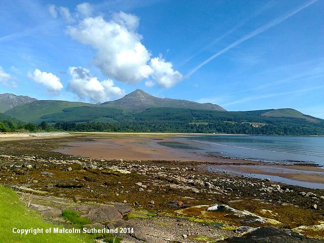
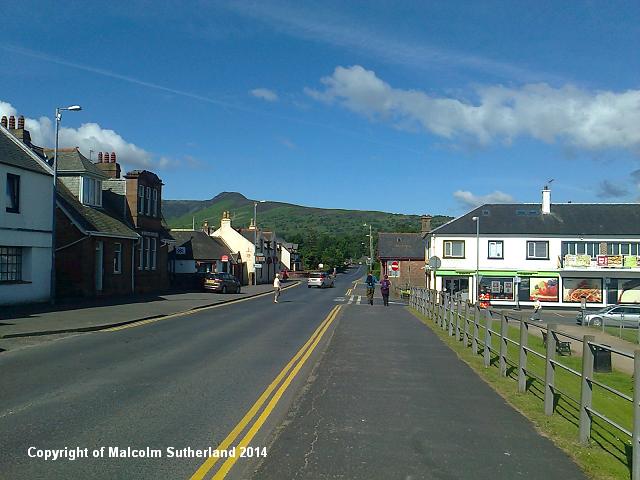
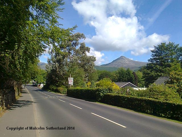
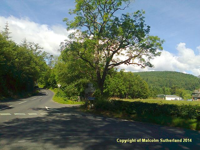
Glen Rosa is located just outside Brodick, so the ferry terminal and town centre is the obvious starting point. Follow the main road west and along past Brodick Bay beach (photos 1, 2). This road bends sharply to the north after a few hundred yards. Keep walking along the A841, past the houses (photo 3) and the golf course. The pavement ends, and you shall have to walk along the road for another few hundred yards until you reach the B880 / A841 junction (photo 4A). Cross over and walk along the B880 for about 100m until you reach a churchyard and the road on your right that leads to Glen Rosa (photo 4B). (Beware of traffic - several large trucks and buses charge along these roads.)
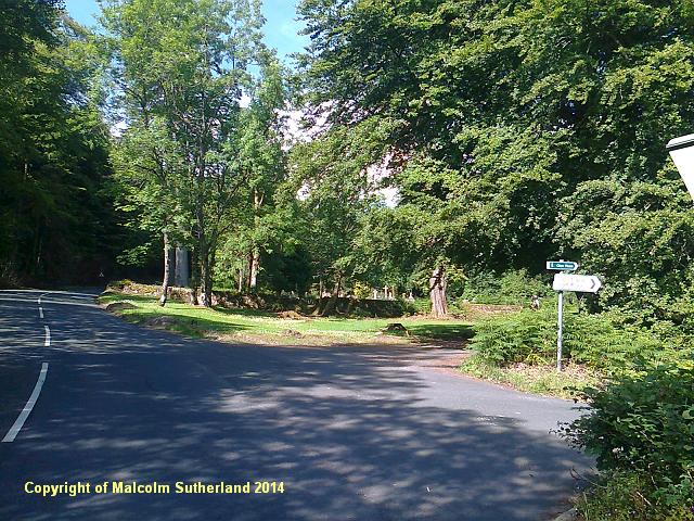
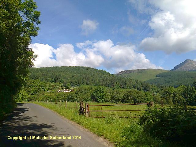
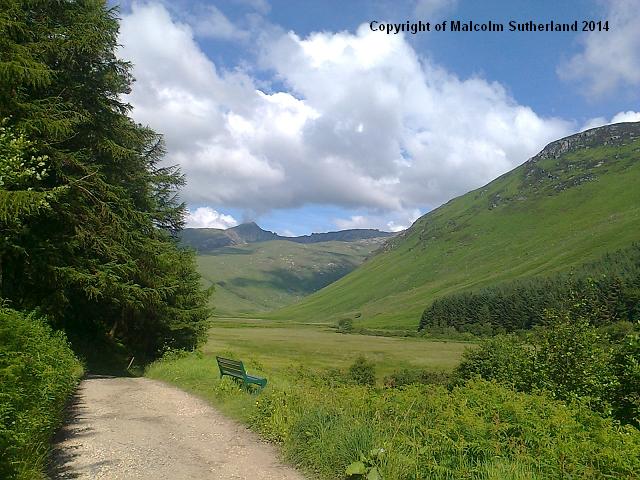
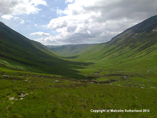
Thankfully the Glen Rosa road is much quieter. This starts out as a narrow tarmac road, bouncing over low hills and meandering its way past isolated cottages (photo 5). The road twists in a westerly direction, then turns north and towards the glen proper. The tarmac becomes fractured, and soon gives way to a gravel road as you enter the glen (photo 6). This gravel track continues past the trees and stretches for another mile and a half (photo 7), until you reach a wooden bridge across a stream where the glen bends north.
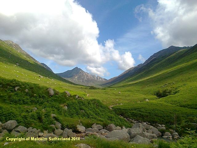
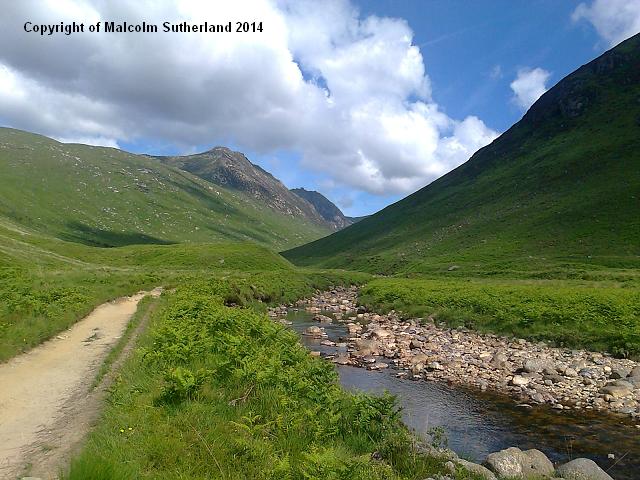
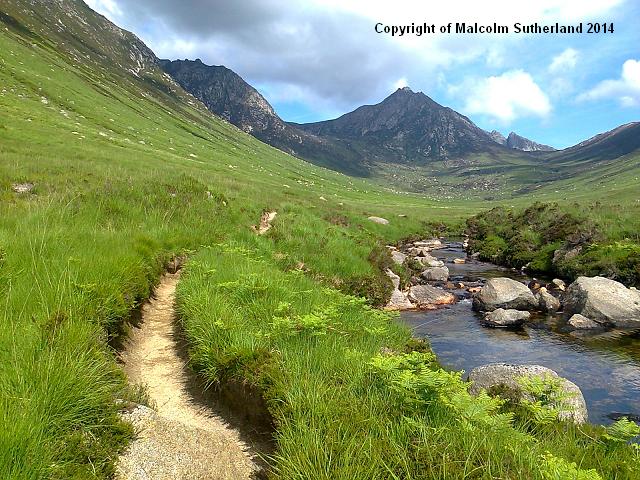
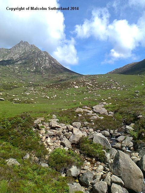
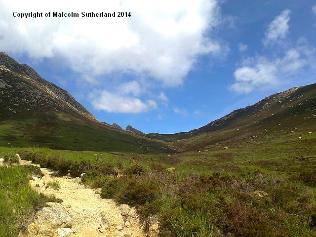
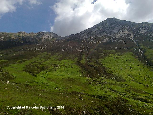
The path beyond the bridge becomes narrow, and is punctured by half-buried boulders and loose stones - more of a hike than a walk. The landscape is grassy, and some sections of the path are narrow dirt channels that cut into the ground (photo 8). As you approach the end of the glen, the boulders around and on the path become more frequent, and there are times when you have to negotiate some tricky boulder crossings (e.g. photo 9). The back and shoulders of Goat Fell stare down this end of the glen (photo 10), and rocks the size of cars pepper the slopes. At the end of the Glen Rosa Water, you shall have to cross a stream filled with moss-coated boulders - not a hurdle to be assailed in a hurry.
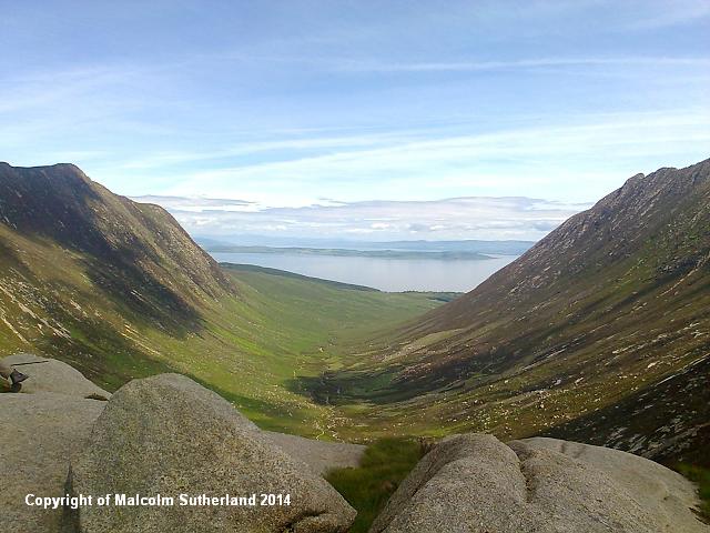
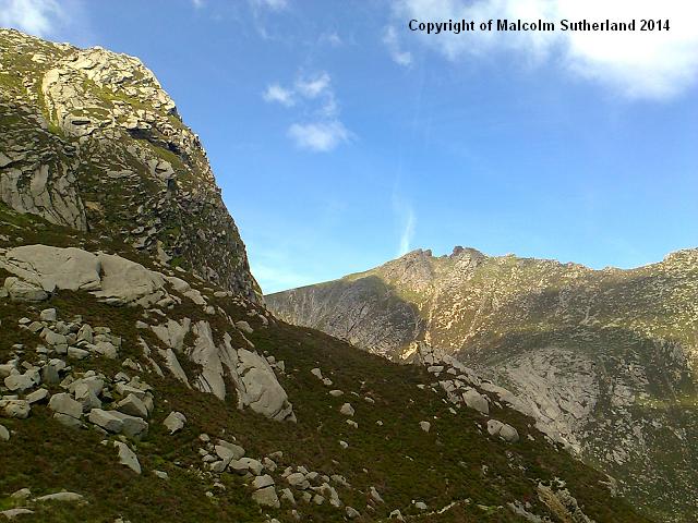
The path follows a steep gradient beyond this crossing. Some sections are in good condition (e.g. in photo 11), and it is evident that volunteers have worked on this route, inserting stone steps and cambers here and there. In general, the path becomes more hap-hazard as you approach the ridge. Once you reach the ridge, you should be rewarded with a sweeping view back down Glen Rosa (photo 12A), and one of Glen Sannox down the other side (photo 12B) - but walkers are NOT advised to clamber down into Glen Sannox as this involves negotiating near-vertical cliffs. The ridge is surrounded by alpine cliffs, which are out of bounds to anyone except experienced mountaineers (photo 12C).
Glen Rosa is located just outside Brodick, so the ferry terminal and town centre is the obvious starting point. Follow the main road west and along past Brodick Bay beach (photos 1, 2). This road bends sharply to the north after a few hundred yards. Keep walking along the A841, past the houses (photo 3) and the golf course. The pavement ends, and you shall have to walk along the road for another few hundred yards until you reach the B880 / A841 junction (photo 4A). Cross over and walk along the B880 for about 100m until you reach a churchyard and the road on your right that leads to Glen Rosa (photo 4B). (Beware of traffic - several large trucks and buses charge along these roads.)
Thankfully the Glen Rosa road is much quieter. This starts out as a narrow tarmac road, bouncing over low hills and meandering its way past isolated cottages (photo 5). The road twists in a westerly direction, then turns north and towards the glen proper. The tarmac becomes fractured, and soon gives way to a gravel road as you enter the glen (photo 6). This gravel track continues past the trees and stretches for another mile and a half (photo 7), until you reach a wooden bridge across a stream where the glen bends north.
The path beyond the bridge becomes narrow, and is punctured by half-buried boulders and loose stones - more of a hike than a walk. The landscape is grassy, and some sections of the path are narrow dirt channels that cut into the ground (photo 8). As you approach the end of the glen, the boulders around and on the path become more frequent, and there are times when you have to negotiate some tricky boulder crossings (e.g. photo 9). The back and shoulders of Goat Fell stare down this end of the glen (photo 10), and rocks the size of cars pepper the slopes. At the end of the Glen Rosa Water, you shall have to cross a stream filled with moss-coated boulders - not a hurdle to be assailed in a hurry.
The path follows a steep gradient beyond this crossing. Some sections are in good condition (e.g. in photo 11), and it is evident that volunteers have worked on this route, inserting stone steps and cambers here and there. In general, the path becomes more hap-hazard as you approach the ridge. Once you reach the ridge, you should be rewarded with a sweeping view back down Glen Rosa (photo 12A), and one of Glen Sannox down the other side (photo 12B) - but walkers are NOT advised to clamber down into Glen Sannox as this involves negotiating near-vertical cliffs. The ridge is surrounded by alpine cliffs, which are out of bounds to anyone except experienced mountaineers (photo 12C).
All text, maps and imagery are copyright of Dr Malcolm Sutherland (2013 - 14).
DISCLAIMER: visitors to this website must take all necessary precautions when travelling to the sites listed in this website and when walking. People viewing this website are entirely responsible for their own transportation, health and safety if they travel to relevant locations and attempt any of the walks listed on this website.
DISCLAIMER: visitors to this website must take all necessary precautions when travelling to the sites listed in this website and when walking. People viewing this website are entirely responsible for their own transportation, health and safety if they travel to relevant locations and attempt any of the walks listed on this website.
