18 - DUNOON AND BUSHOP'S GLEN
Dunoon is a fairly large, bustling town by Argyll standards, and - almost like a Victorian city suburb - boasts a splendid parkland a few streets away from the town centre. The Bishop's Glen rests a little uneasily alongside large tracts of commercial forestry land, and visitors must obey warning signs placed around the periphery of the parkland. In recent years, a narrow winding path that scales the hillside has been open to walkers, and provides a challenging hike for the local resident and tourist alike. The top of this route provides of the best views across the Firth of Clyde towards Greenock and Dumbarton.
NB: walkers should not try to venture towards Bishop's Seat as this is out of bounds.
NB: walkers should not try to venture towards Bishop's Seat as this is out of bounds.
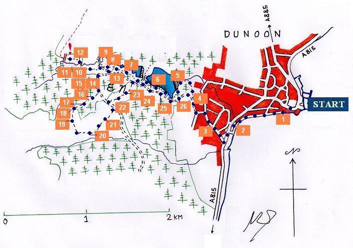
Bishop's Glen sits behind the picturesque town of Dunoon, under the spectre of Bishop's Seat. Sadly, that hill is not open to the public, and there is no easy or legal route to the summit. Nevertheless, a path which reaches the plateau overlooking the Clyde was recently opened to the public. This walk should not be attempted in rain or heavy mist. Watch out for low-lying clouds sweeping in from the west during overcast and rainy weather.
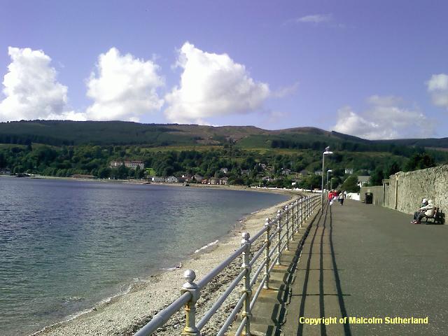
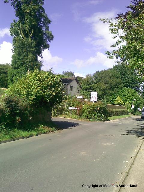
The best way to access Dunoon is by ferry, so the only real starting point is the ferry terminal. There is a short but very pleasant promenade heading westward, past the castle hill, towards the foothills (photo 1). Approach the two bridges (the A815 road and the old disused road), cross the grass and head up Glenmorag Avenue (photo 2). Turn right and walk along Kilbride Road, where you will see a signpost at the end of Crochan Road (photo 3). Turn and walk up the fairly steep road, where the entrance into Bishop's Glen is on the right. Walk along the gravel road for about 100 yards until you reach a crossroads; take the path to your right (photo 4).
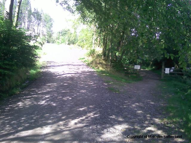
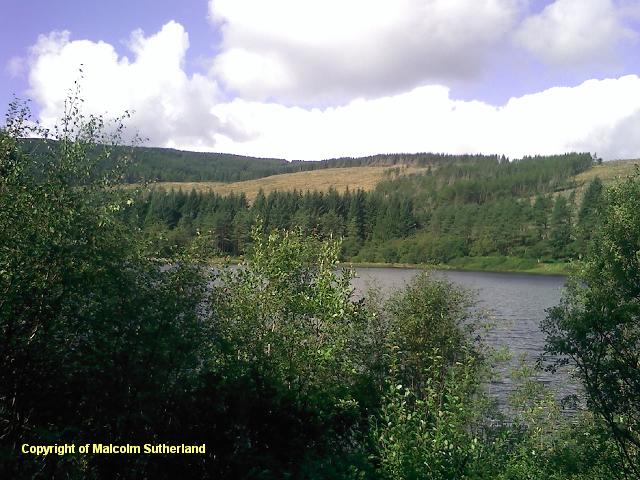
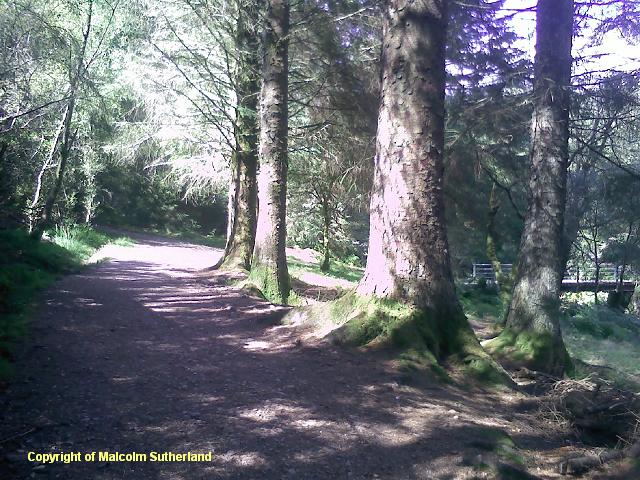
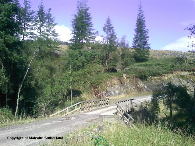
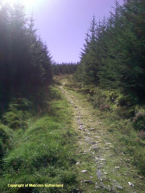
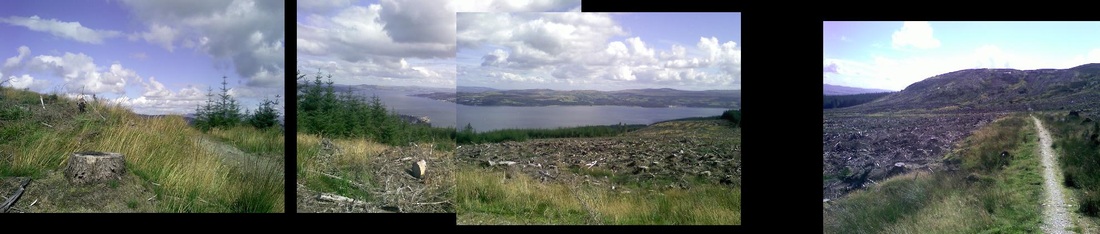
This slightly narrower path meanders alongside the wide gravel road. However, there is an initial detour, up to the dam and the Bishops' Glen reservoirs (photo 5). This path snakes its way through the woods (photo 6), past a couple of bridges to the right, plus regular turn-offs to the left back onto the gravel road (photo 7). Ignore the turn-offs and keep walking straight ahead. The path becomes slightly narrower and the woodland becomes denser (with shorter trees) (photo 8), shortly before you reach the large bridge, where the path meets the gravel road again. (Do not turn right or cross the bridge: this leads into commercial forestry land.)
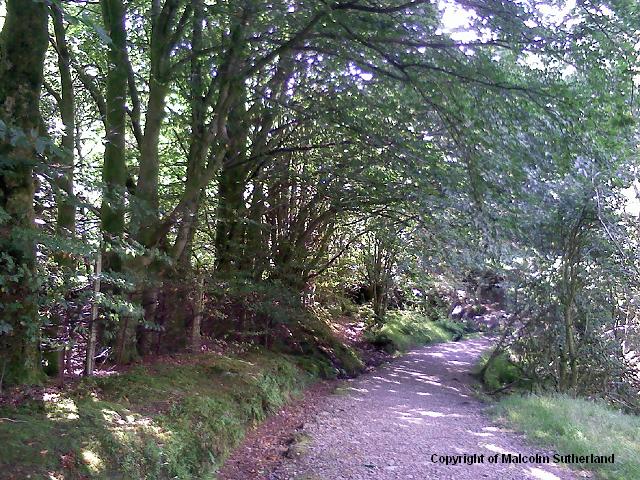
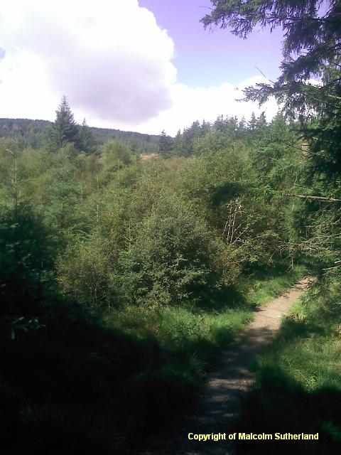
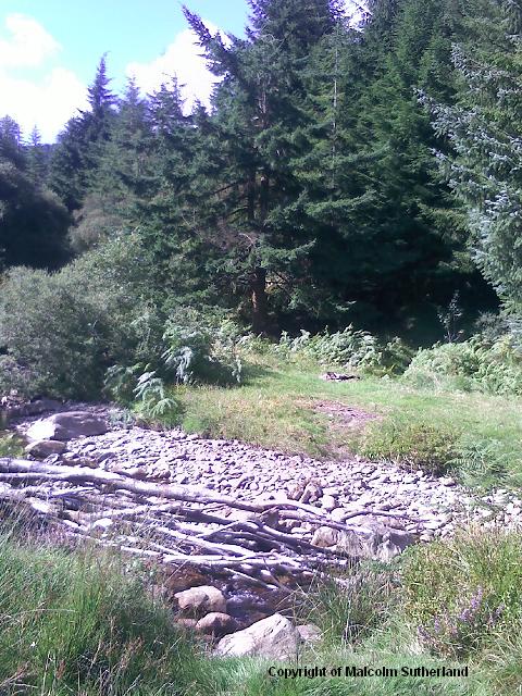
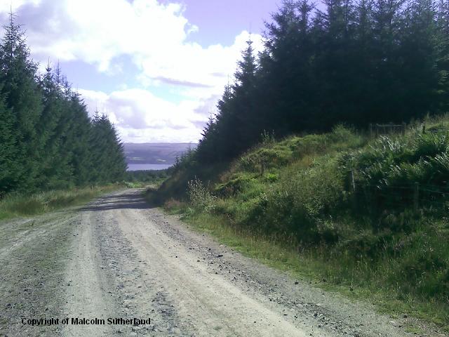
Cross over the gravel road, and follow the narrow, grassy track along the river (photos 10, 11). You can cross the river quite easily. From there onwards, the track continues for about 200 yards (photo 12). Sadly, this is a dead end, and you shall have to turn back. When you reach the gravel road, turn south (i.e. right) and climb the hill until you reach a crossroads (photo 13). Turn right and head up the steeper gravel road (photo 14). This continues for about half a mile, until you reach a very steep track on the right (photo 15).
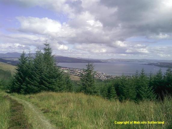
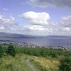
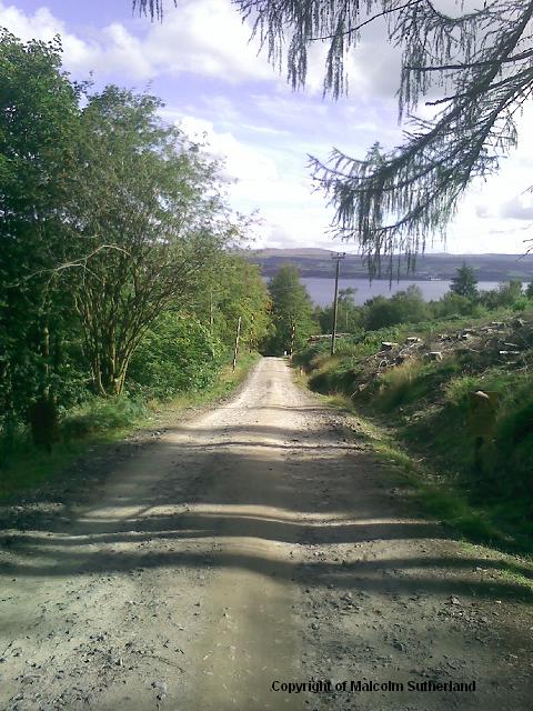
The steep track on the right is hard to miss. The path is narrow and rocky, and very slippery in cold weather. The path is unrepentantly steep (photo 16). However, the difficult ascent is aided by the first impressive views down to Dunoon and of The Firth of Clyde (photo 17). Eventually the path levels out and turns a corner (photo 18), and the highest point is about another 100 yards (photo 19a). The path is out of the woods, and the walker is (should be) rewarded with views of Dunoon, Gourock, the hills behind Greenock, and Dumbartonshire (photo 19b).
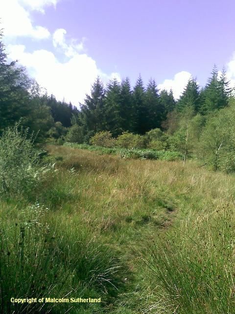
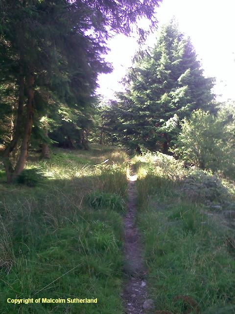
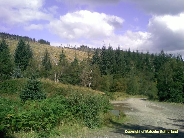
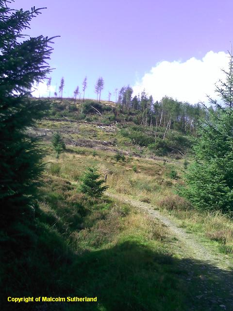
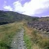
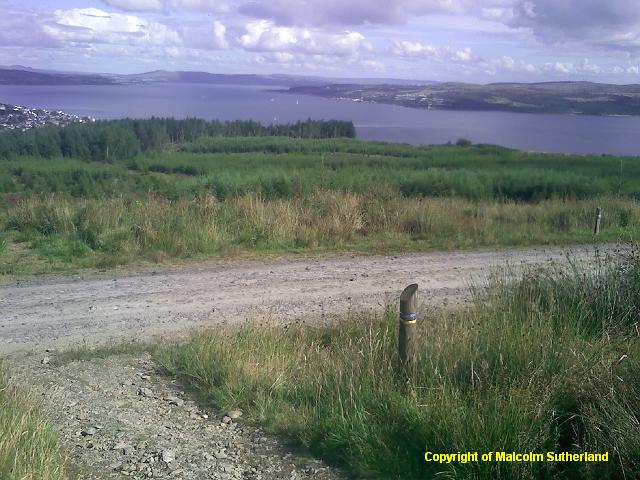
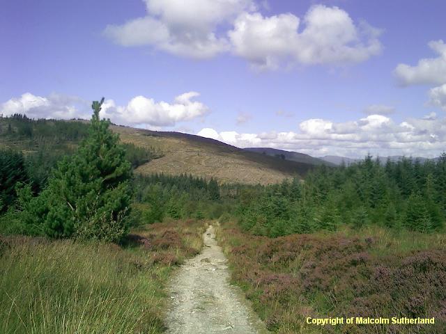
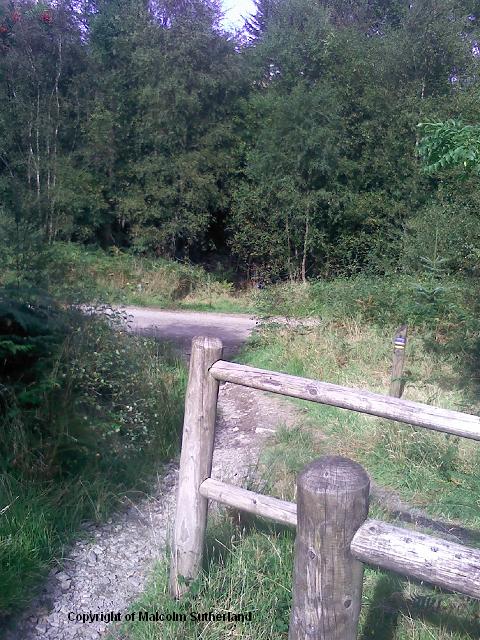
The woodland around the path has been felled recently (photo 20), but there are several signposts to remind the walker that he/she is here only with kind permission, and must adhere to the designated path. The path scrambles back down a steep hill (photo 21), until it meets another gravel road (photo 22). Turn left and walk along for about 100 yards, until you see a path on the right, marked by a wooden post with some red and blue painted rings. Carry on down the path (which is also outside the woods) (photo 23), until you reach a stile (photo 24).
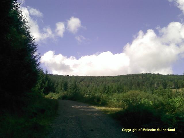
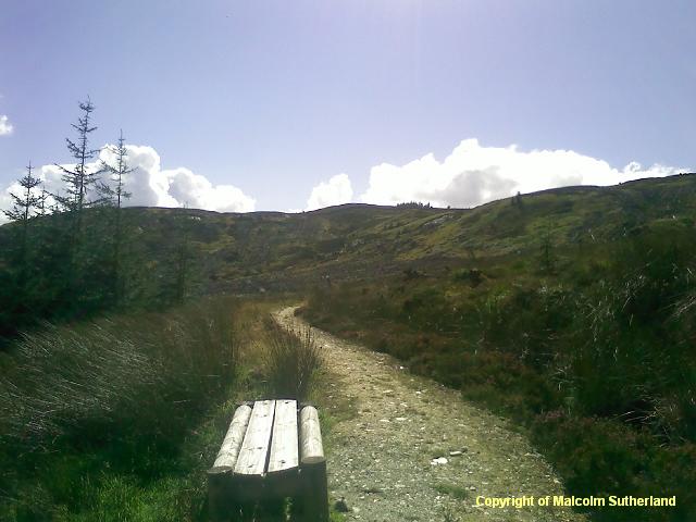
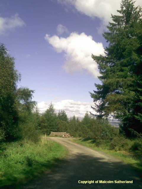
Turn right, and follow the gravel road back into Dunoon. There is not much to see for this last half-mile, although the walk is still reasonably picturesque in good weather (photos 25, 26).
The best way to access Dunoon is by ferry, so the only real starting point is the ferry terminal. There is a short but very pleasant promenade heading westward, past the castle hill, towards the foothills (photo 1). Approach the two bridges (the A815 road and the old disused road), cross the grass and head up Glenmorag Avenue (photo 2). Turn right and walk along Kilbride Road, where you will see a signpost at the end of Crochan Road (photo 3). Turn and walk up the fairly steep road, where the entrance into Bishop's Glen is on the right. Walk along the gravel road for about 100 yards until you reach a crossroads; take the path to your right (photo 4).
This slightly narrower path meanders alongside the wide gravel road. However, there is an initial detour, up to the dam and the Bishops' Glen reservoirs (photo 5). This path snakes its way through the woods (photo 6), past a couple of bridges to the right, plus regular turn-offs to the left back onto the gravel road (photo 7). Ignore the turn-offs and keep walking straight ahead. The path becomes slightly narrower and the woodland becomes denser (with shorter trees) (photo 8), shortly before you reach the large bridge, where the path meets the gravel road again. (Do not turn right or cross the bridge: this leads into commercial forestry land.)
Cross over the gravel road, and follow the narrow, grassy track along the river (photos 10, 11). You can cross the river quite easily. From there onwards, the track continues for about 200 yards (photo 12). Sadly, this is a dead end, and you shall have to turn back. When you reach the gravel road, turn south (i.e. right) and climb the hill until you reach a crossroads (photo 13). Turn right and head up the steeper gravel road (photo 14). This continues for about half a mile, until you reach a very steep track on the right (photo 15).
The steep track on the right is hard to miss. The path is narrow and rocky, and very slippery in cold weather. The path is unrepentantly steep (photo 16). However, the difficult ascent is aided by the first impressive views down to Dunoon and of The Firth of Clyde (photo 17). Eventually the path levels out and turns a corner (photo 18), and the highest point is about another 100 yards (photo 19a). The path is out of the woods, and the walker is (should be) rewarded with views of Dunoon, Gourock, the hills behind Greenock, and Dumbartonshire (photo 19b).
The woodland around the path has been felled recently (photo 20), but there are several signposts to remind the walker that he/she is here only with kind permission, and must adhere to the designated path. The path scrambles back down a steep hill (photo 21), until it meets another gravel road (photo 22). Turn left and walk along for about 100 yards, until you see a path on the right, marked by a wooden post with some red and blue painted rings. Carry on down the path (which is also outside the woods) (photo 23), until you reach a stile (photo 24).
Turn right, and follow the gravel road back into Dunoon. There is not much to see for this last half-mile, although the walk is still reasonably picturesque in good weather (photos 25, 26).

All text, maps and imagery are copyright of Dr Malcolm Sutherland (2013 - 14).
DISCLAIMER: visitors to this website must take all necessary precautions when travelling to the sites listed in this website and when walking. People viewing this website are entirely responsible for their own transportation, health and safety if they travel to relevant locations and attempt any of the walks listed on this website.
DISCLAIMER: visitors to this website must take all necessary precautions when travelling to the sites listed in this website and when walking. People viewing this website are entirely responsible for their own transportation, health and safety if they travel to relevant locations and attempt any of the walks listed on this website.
