WALK 10 - THE GREENOCK AND KELLY CUTS
There is almost nothing else in Scotland which compares with the extraordinary 19th century canal chain of the Greenock and Kelly Cuts. A path runs alongside both channels for around 10km, from the outskirts of Greenock, past IBM and the fields near Inverkip, past the reservoirs and fishing grounds (including Loch Thom), into the bleak moorland behind Wemyss Bay. This is a classic Clyde walk which takes the walker from within a conurbation through the surrounding countryside and into the wilderness.
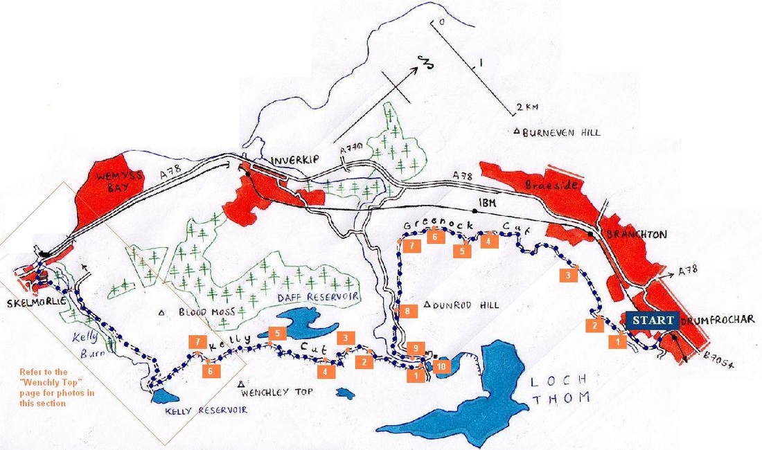
The walker has the option of starting at Wemyss Bay. For this guide, you should take the train or the bus to Drumfrocher. Note that there are two sets of photographs for this guide, for each of the 'cuts'. Also note that the route also covers near all of the route for Wenchly Top, and the reader should refer to this web page.
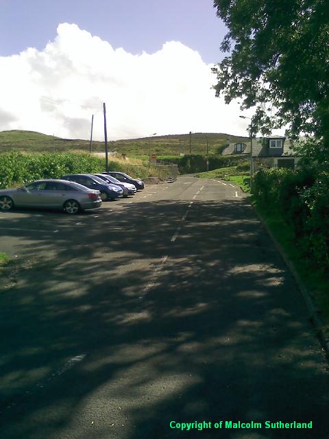
Alight at either stop near/on Cornhaddock Street, and head south up the steep Peat Road (past the bridge over the railway), which becomes Papermill Road. Turn left up the steeper Overton Road and through the car park beside the start of the Greenock Cut (Photo 1).
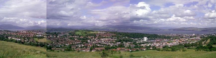
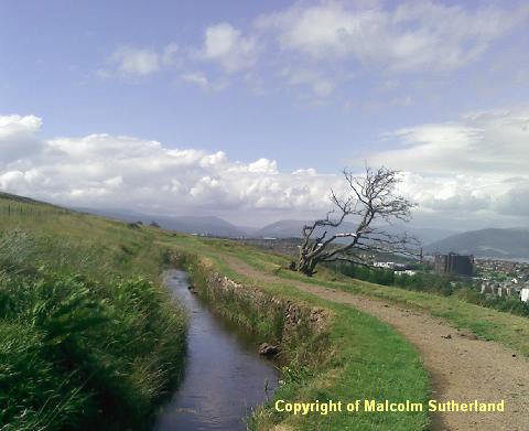
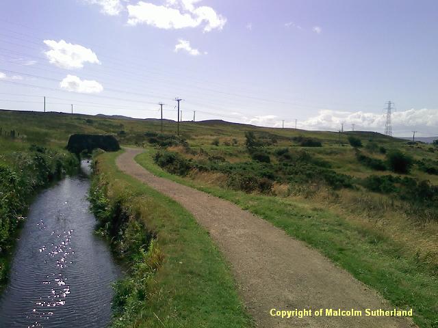
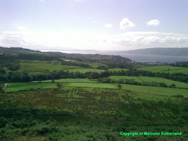
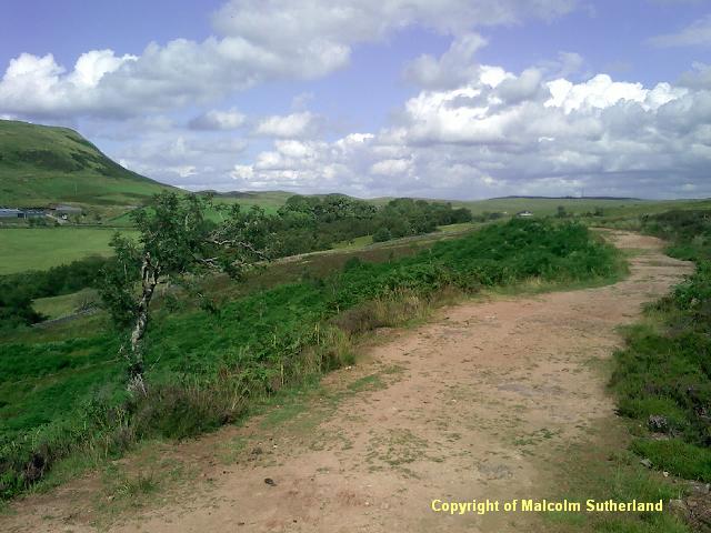
The path alongside the Greenock is a neat, clearly marked gravel path (Photo 2), and is frequented by several locals and tourists, including cyclists. The path bends and twists along with the canal, which both follow the contours of the hill. In general, there is not much to see along the canal itself - just the occassional stone bridge (Photo 3) - although the back hill becomes more dramatic as you depart from Greenock altogether (Photo 4). The main attraction is the view across Greenock and the Clyde (see photo at top of page).
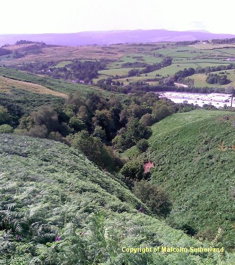
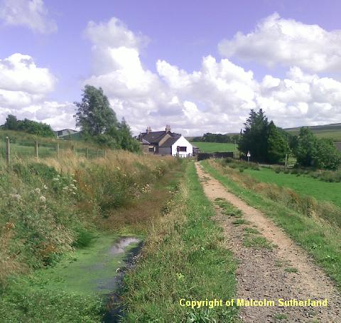
There is a plunging gully and waterfalls below the path, above the IBM site (Photo 5). This is around the point when the path leaves the Spango Valley behind and heads southeast towards Loch Thom (Photo 6). There is a good view towards Inverkip and Argyll around the corner (Photo 7). The path approaches a back road from Inverkip (Photo 8), which leads to the Cornalees Visitor Centre (Photo 10) and the fishing grounds nearby. Cross the back road and carry on along the path through a narrow woodland towards the artificial waterfall outside the visitor centre (Photo 9). Cross the Cornalees bridge to the start of the Kelly Cut).
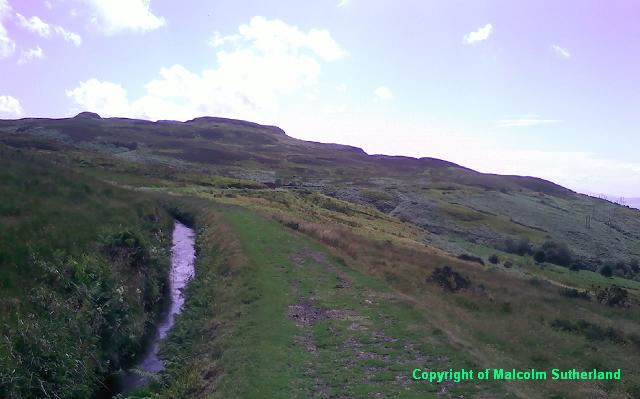
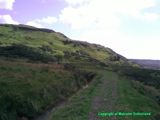
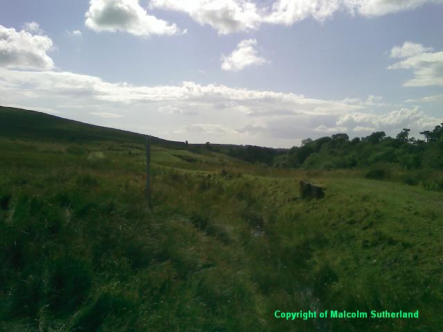
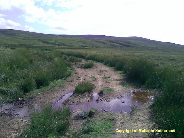
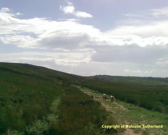
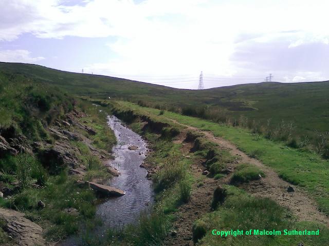
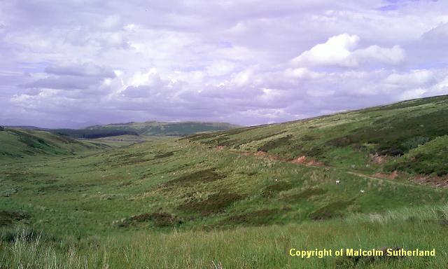
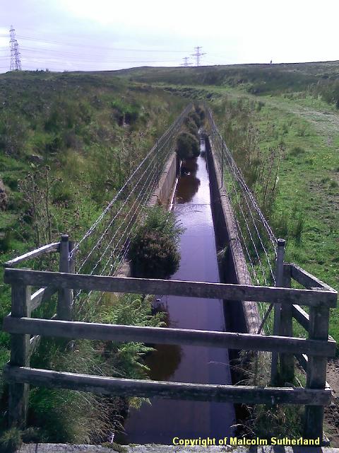
The Kelly Cut is surrounded by wild grass and heather, and the path is narrower and more patchy (Photo 1). with some impressive views of Dunrod Hill and the woodland below (Photo 2). About a mile out, the path becomes boggy and is almost level with the water in the canal, which has collapsed in places (Photo 3). The canal is more intact further along as you head southwest past Daff Reservoir and towards Wenchly Top (Photo 4). The canal and path follow a long straight route for about a mile (Photos 5 and 6), where the path is mainly grass. They then make a sharp turn west, until the canal is a narrow channel in a concrete chute, near the top of the ridge (Photo 7).
By the time you reach the top of the ridge, you'll catch sight of the path heading down the Kelly Glen towards Wemyss Bay. Instructions for this route are provided for Wenchly Top.
GREENOCK CUT PHOTOS
Alight at either stop near/on Cornhaddock Street, and head south up the steep Peat Road (past the bridge over the railway), which becomes Papermill Road. Turn left up the steeper Overton Road and through the car park beside the start of the Greenock Cut (Photo 1).
The path alongside the Greenock is a neat, clearly marked gravel path (Photo 2), and is frequented by several locals and tourists, including cyclists. The path bends and twists along with the canal, which both follow the contours of the hill. In general, there is not much to see along the canal itself - just the occassional stone bridge (Photo 3) - although the back hill becomes more dramatic as you depart from Greenock altogether (Photo 4). The main attraction is the view across Greenock and the Clyde (see photo at top of page).
There is a plunging gully and waterfalls below the path, above the IBM site (Photo 5). This is around the point when the path leaves the Spango Valley behind and heads southeast towards Loch Thom (Photo 6). There is a good view towards Inverkip and Argyll around the corner (Photo 7). The path approaches a back road from Inverkip (Photo 8), which leads to the Cornalees Visitor Centre (Photo 10) and the fishing grounds nearby. Cross the back road and carry on along the path through a narrow woodland towards the artificial waterfall outside the visitor centre (Photo 9). Cross the Cornalees bridge to the start of the Kelly Cut).
The Kelly Cut is surrounded by wild grass and heather, and the path is narrower and more patchy (Photo 1). with some impressive views of Dunrod Hill and the woodland below (Photo 2). About a mile out, the path becomes boggy and is almost level with the water in the canal, which has collapsed in places (Photo 3). The canal is more intact further along as you head southwest past Daff Reservoir and towards Wenchly Top (Photo 4). The canal and path follow a long straight route for about a mile (Photos 5 and 6), where the path is mainly grass. They then make a sharp turn west, until the canal is a narrow channel in a concrete chute, near the top of the ridge (Photo 7).
By the time you reach the top of the ridge, you'll catch sight of the path heading down the Kelly Glen towards Wemyss Bay. Instructions for this route are provided for Wenchly Top.
GREENOCK CUT PHOTOS

KELLY CUT PHOTOS
All text, maps and imagery are copyright of Dr Malcolm Sutherland (2013 - 14).
DISCLAIMER: visitors to this website must take all necessary precautions when travelling to the sites listed in this website and when walking. People viewing this website are entirely responsible for their own transportation, health and safety if they travel to relevant locations and attempt any of the walks listed on this website.
DISCLAIMER: visitors to this website must take all necessary precautions when travelling to the sites listed in this website and when walking. People viewing this website are entirely responsible for their own transportation, health and safety if they travel to relevant locations and attempt any of the walks listed on this website.
