walk 20 - bromley muir
This fairly unremarkable foothill a few miles inland from Dumbarton offers some spectacular views: the Firth of Clyde; the Port Glasgow - Greenock urban sprawl on the other shore; as well as a prospect of Loch Lomond and the mountains to the northeast. This walk does not stray far from the city, but walkers should come prepared. The path is steep and marshy in places, and the narrow Cardross Road can be unexpectedly busy. Nevertheless, this is a worthy route in an area beside the firth that is underrepresented in this series of walks.
Despite its verdant farmland, ascending foothills and straddling sections of sandy beach, there is a distinct paucity of countryside trails between Kilcreggan and Dumbarton. Perhaps the nearby Arroachar Alps, along with the mountains leering over Loch Lomond, pose as strong competitors for the tourist rabble. Bromley Muir is not exactly the most famous tourist route either; much of this walk follows power lines (beyond the Carman fishing reservoir), and walkers must keep their distance.
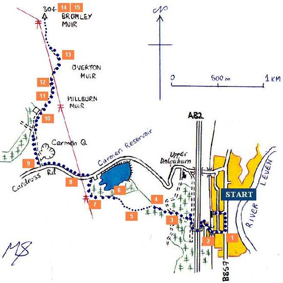
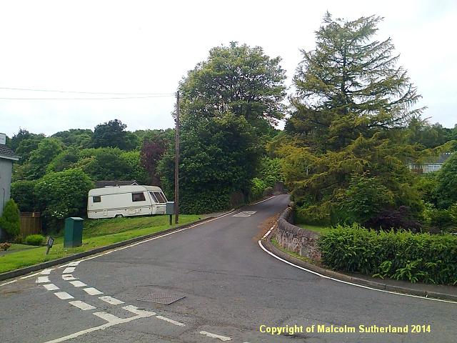
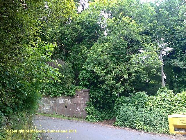
This walk begins in the centre of Renton. There are two routes up to the fishing reservoir: one is the Cardross Road, which is narrow, meandering and very steep, and frequented by fast cars; the other starts at Carman Road (photo 1), and becomes a scanty trail through woodland and a boggy field. This may seem like a choice between the devil and the deep green moss, but the safer route is definitely the trail, which starts as a path breaking off from a twisting Carman Road (photo 2), and a footbridge over the A82 dual carriageway. Turn right at the end of the footbridge and follow the West Carman Road for a few metres, after which you will see a signpost for the path (marked 'Cardross').
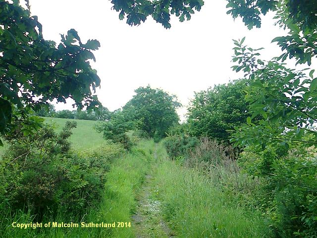
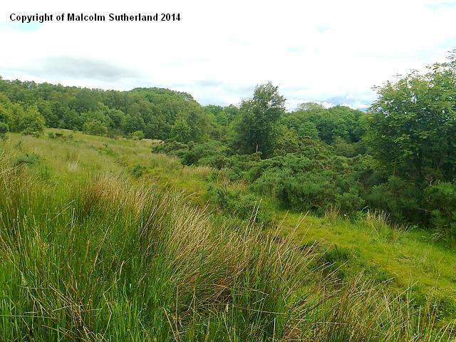
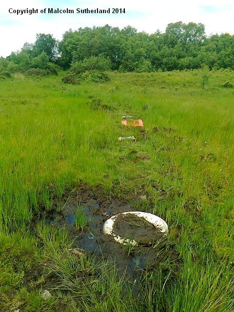
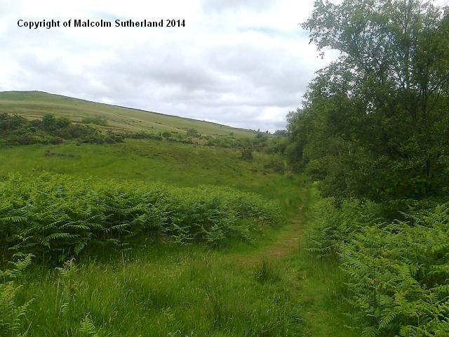
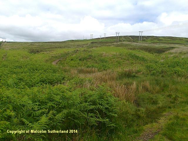
This path commences as a series of steps entering some woodland, before you briefly cross the farm track (to Upper Dalquhurn farm), and onto a grassy, narrower path (photo 3). After crossing over a stile, you'll see a wall and a faint trail to the right (photo 4) - avoid this, as the trail degenerates into marsh and dies in the woods. There is a faint trail to your left, up the hill. Be careful as you cross the field, where the marsh can be deep in places - there are even two lifebelts! (Photo 5) Persist your way past the field and towards the fishing reservoir (photo 6), and keep following the perimeter path, which is generally easier underfoot (photo 7).
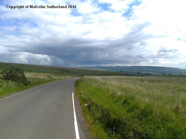
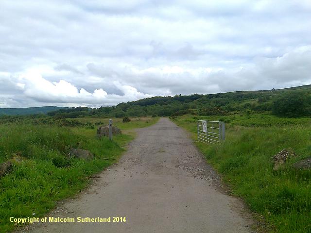
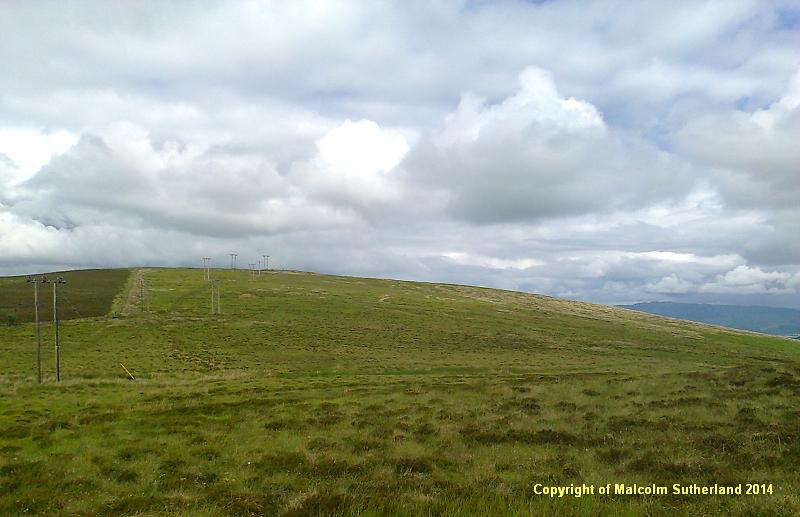
When you reach the end, you shall have to turn left and walk along the Cardross Road for about 300 metres (photo 8). This road has blind summits, and 4x4s and farm vehicles frequently make a swift, almost unannounced approach. Once you reach the top of the ridge, you will see a wide metalled road to your right (photo 9). Follow this road past the Carman Quarry. The gradient toughens as you approach a junction, where the main metalled road veers to the left. Turn right and follow the narrower, grassier and steeper route up to the old reservoir, where the view towards Port Glasgow starts to open up (photo 10).
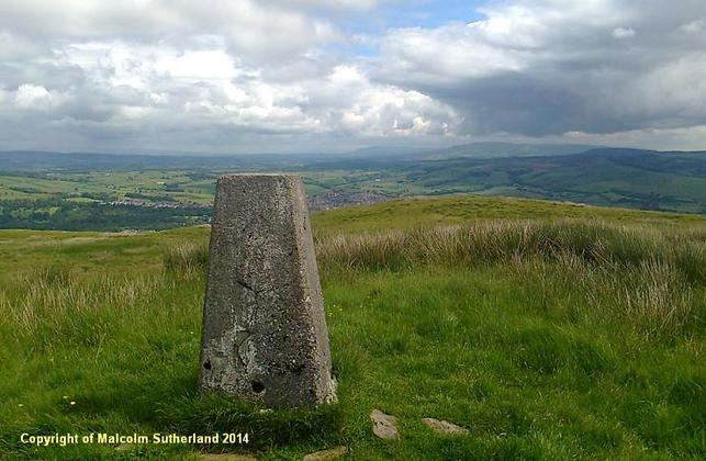
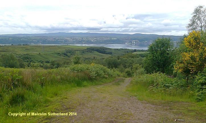
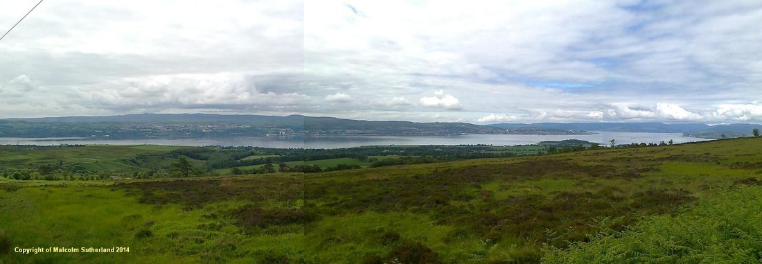
The path becomes a grassy trail (photo 11), which is muddy in places due to articulated power company service vehicles accessing the power lines. As you ascend the hill gently but steadily, the view to the south becomes a grand sweep along the firth, from Dumbarton, via Langbank, via Port Glasgow and Greenock, round to Gourock and the Argyll hills to the west (photo 12). The path soon reaches a plateau, and you descend slightly, down from Overton Muir and across a marshy peat bog towards Bromley Muir hill itself (photo 13). The trig point is visible throughout this last section.
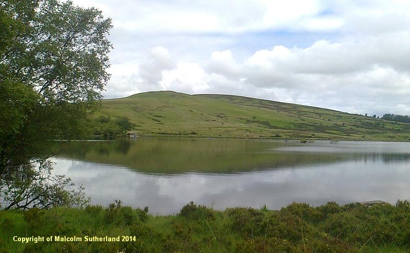
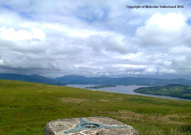
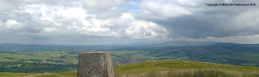
The views from this clearly marked summit can be rewarding - that is, if you ignore the power lines to your west. The views across Loch Lomond (photo 14) and to the Campsie Fells and Fintry Hills (photo 15) make this off-the-beaten-trail walk worthwhile. (One may be tempted to carry on following the trail north and towards Balloch - don't. This was attempted by the author recently, who learned - the hard way - that the trail disappeared into tufts and bright green marshy moss.)
This walk begins in the centre of Renton. There are two routes up to the fishing reservoir: one is the Cardross Road, which is narrow, meandering and very steep, and frequented by fast cars; the other starts at Carman Road (photo 1), and becomes a scanty trail through woodland and a boggy field. This may seem like a choice between the devil and the deep green moss, but the safer route is definitely the trail, which starts as a path breaking off from a twisting Carman Road (photo 2), and a footbridge over the A82 dual carriageway. Turn right at the end of the footbridge and follow the West Carman Road for a few metres, after which you will see a signpost for the path (marked 'Cardross').
This path commences as a series of steps entering some woodland, before you briefly cross the farm track (to Upper Dalquhurn farm), and onto a grassy, narrower path (photo 3). After crossing over a stile, you'll see a wall and a faint trail to the right (photo 4) - avoid this, as the trail degenerates into marsh and dies in the woods. There is a faint trail to your left, up the hill. Be careful as you cross the field, where the marsh can be deep in places - there are even two lifebelts! (Photo 5) Persist your way past the field and towards the fishing reservoir (photo 6), and keep following the perimeter path, which is generally easier underfoot (photo 7).
When you reach the end, you shall have to turn left and walk along the Cardross Road for about 300 metres (photo 8). This road has blind summits, and 4x4s and farm vehicles frequently make a swift, almost unannounced approach. Once you reach the top of the ridge, you will see a wide metalled road to your right (photo 9). Follow this road past the Carman Quarry. The gradient toughens as you approach a junction, where the main metalled road veers to the left. Turn right and follow the narrower, grassier and steeper route up to the old reservoir, where the view towards Port Glasgow starts to open up (photo 10).
The path becomes a grassy trail (photo 11), which is muddy in places due to articulated power company service vehicles accessing the power lines. As you ascend the hill gently but steadily, the view to the south becomes a grand sweep along the firth, from Dumbarton, via Langbank, via Port Glasgow and Greenock, round to Gourock and the Argyll hills to the west (photo 12). The path soon reaches a plateau, and you descend slightly, down from Overton Muir and across a marshy peat bog towards Bromley Muir hill itself (photo 13). The trig point is visible throughout this last section.
The views from this clearly marked summit can be rewarding - that is, if you ignore the power lines to your west. The views across Loch Lomond (photo 14) and to the Campsie Fells and Fintry Hills (photo 15) make this off-the-beaten-trail walk worthwhile. (One may be tempted to carry on following the trail north and towards Balloch - don't. This was attempted by the author recently, who learned - the hard way - that the trail disappeared into tufts and bright green marshy moss.)
All text, maps and imagery are copyright of Dr Malcolm Sutherland (2013 - 14).
DISCLAIMER: visitors to this website must take all necessary precautions when travelling to the sites listed in this website and when walking. People viewing this website are entirely responsible for their own transportation, health and safety if they travel to relevant locations and attempt any of the walks listed on this website.
DISCLAIMER: visitors to this website must take all necessary precautions when travelling to the sites listed in this website and when walking. People viewing this website are entirely responsible for their own transportation, health and safety if they travel to relevant locations and attempt any of the walks listed on this website.
