walk 11 - gourock circuit
Largs, Dunoon and Clydebank are blessed with splended steep hills and rugged moorland behind them. Gourock is even better - the rugged topography is an integral part of the town. Many of its tenements, roads and grand houses hug the corners and tough slopes of its many hills, including Tower Hill, Burneven Hill and Craigs Top. This walk may not cover a long distance on the map, but covers a considerable distance, in terms of altitude. Even so, this is essentially an urban walk, which can be completed even in mid-winter.
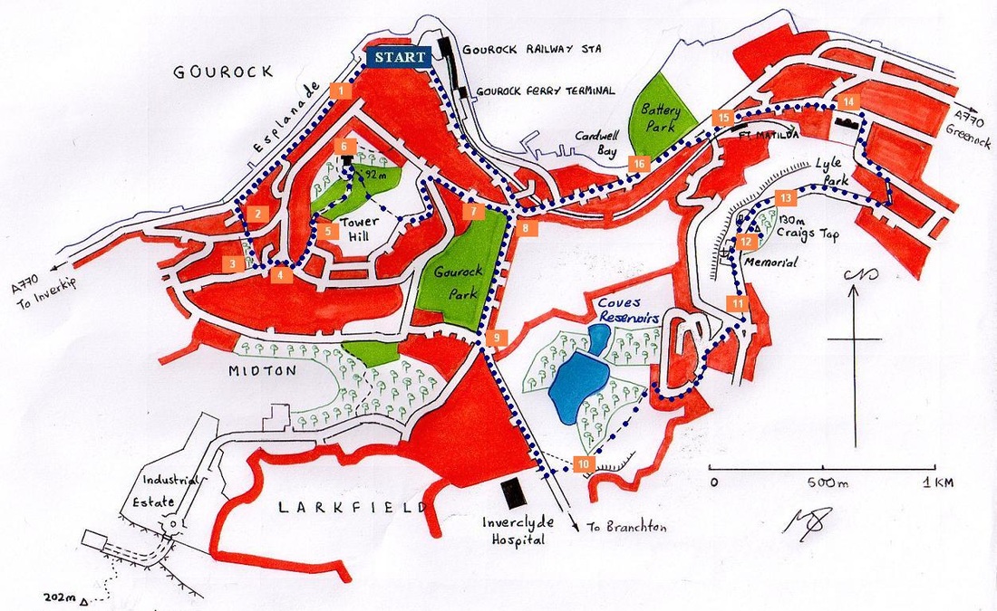
The starting point for this walk is Gourock railway station, which is beside the Gourock bus stop. This guide follows the route in an anti-clockwise direction, which makes for a slightly tougher walk.
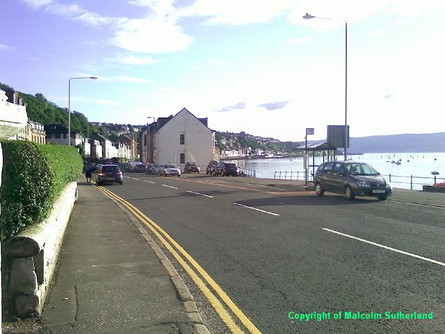
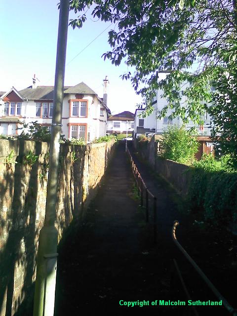
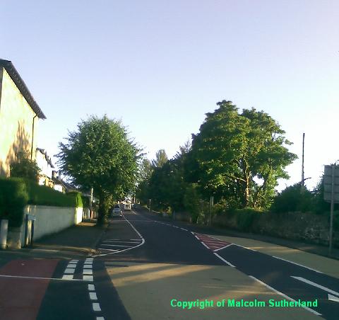
Walk along Kempock Street, which becomes Albert Road as it runs parallel to the exquisite Gourock promenade (Photo 1). The walker may choose to turn left and up the very steep Hillside Road, and turn right onto Barrhill Road. However, for a more dramatic ascent, walk slightly further along and turn left at Ashton Place, behind the pub. There is a long stairway up the hill (Photo 2), leading to Victoria Road. At the top of the passage, you'll see a small park almost directly across the road (Photo 3). Walk through the park up the hill, and onto Divert Road, which joins with Barrhill Road (Photo 4), which in turn becomes Tower Drive.
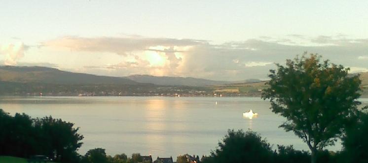
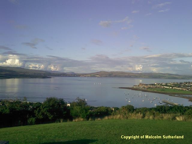
Follow Tower Drive for a short distance, and turn left and up McPherson Drive, which leads to a narrow road entering Tower Hill Park (Photo 5). Walk along the road, which leads all the way to the tower itself (Photo 6a). This hill is less than 100m in height, but offers a commanding view across the Clyde, and towards Dumbartonshire (Photo 6b).
There is a narrow track leading south from the tower and down a passage towards Fletcher Avenue, down a moderate hill. Follow Flether Avenue, which twists left and meets a hair-pin multiple junction. Cross the roads and walk along Broomberry Drive towards the Larkfield Road/Shore Street junction; by now, you'll catch a glimpse of Craigs Top, and the monuments on top (Photo 7).
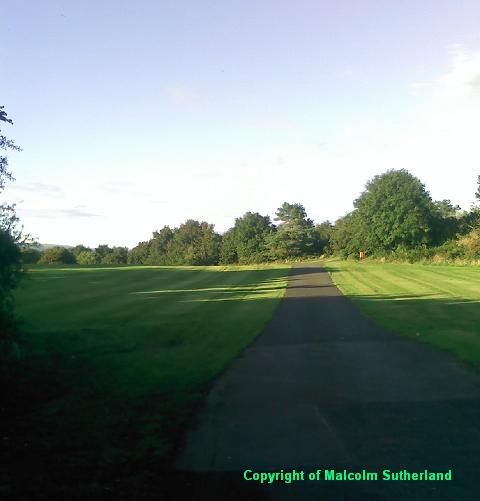
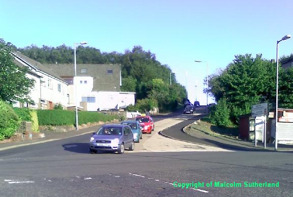
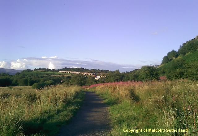
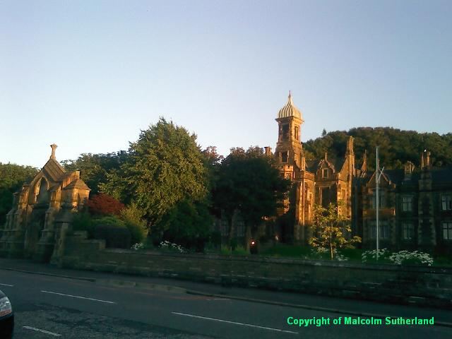
Heave up the relentlessly steep Larkfield Road (Photo 8) until you reach a junction. Turn slightly left and up the even steeper Hilltop Road (Photo 9), which leads to the unmistakable Inverclyde Hospital building. On the other side of the exit road from the hospital is a path leading into the parkland with the Coves reservoirs. This walk disappears into near-moorland (Photo 10), but which is overlooked by the housing estate of Fancy Farm. The path meets another path, which leads to Mallard Crescent. Follow this road ahead and pass through the back of the estate, along a short path, towards Merlin Lane, and then up the hill (Merlin Avenue) towards the junction and Lyle Road.
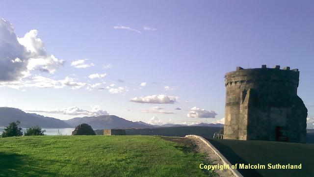
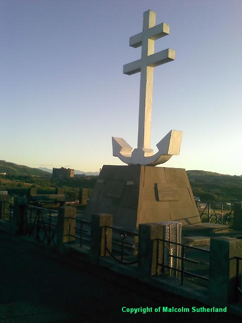
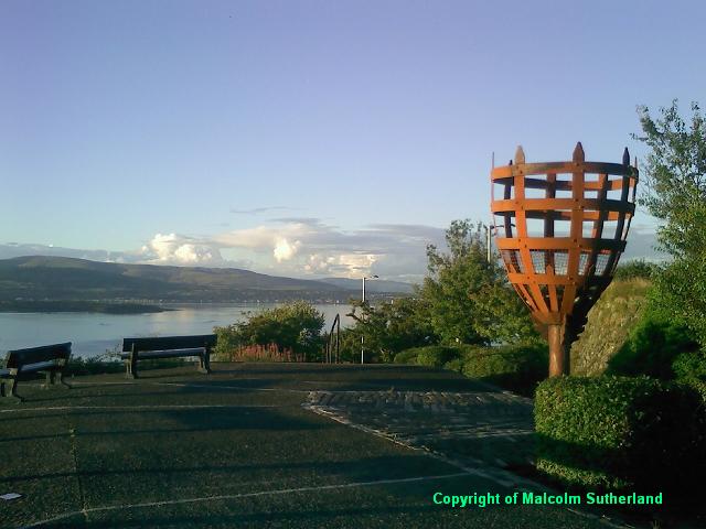
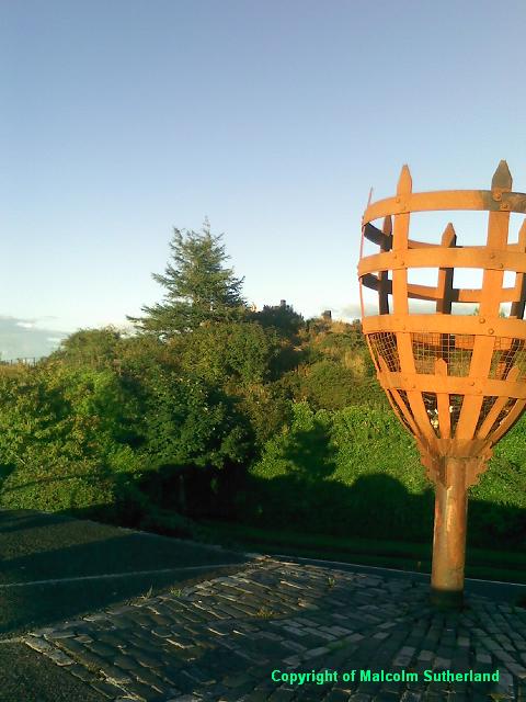
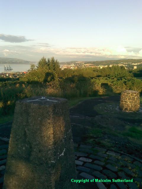
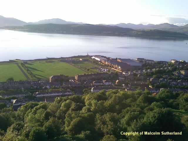
Climb Lyle Road towards the monuments (Photo 11). The first is a memorial to the Free French Soldiers who died in WWII, with its enormous, white anchor (Photo 12a). Further along is a torch, which is sometimes lit in winter (Photos 12b, 12c). Nearby is the top of Craig Hill, with a trigpoint (photos 12c, 12d). The top of the hill is across the road (watch for fast traffic), and behind a small network of paths. The balcony in front of the torch offers commanding views down on Fort Matilda, including the railway station (Photo 12e) and the naval base.
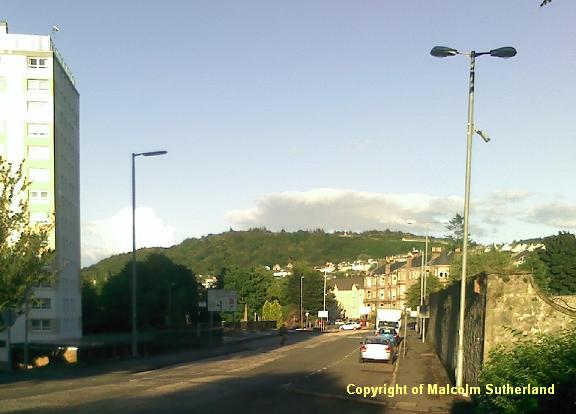
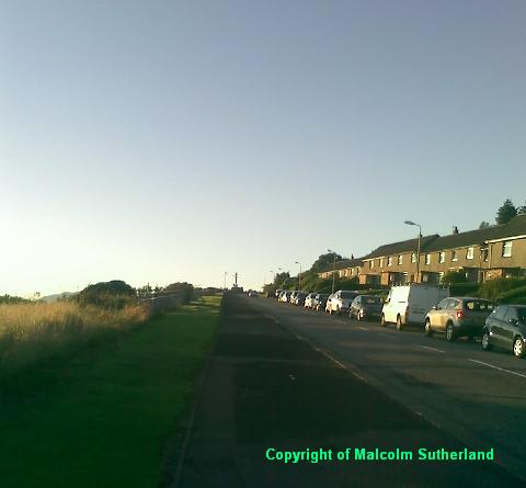
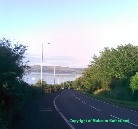
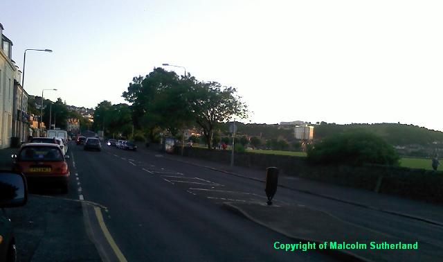
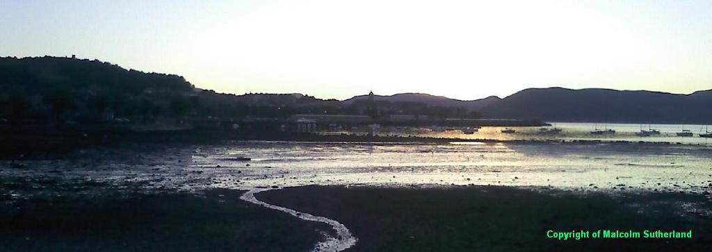
Follow Lyle Road east and downhill (Photo 13). About a half-mile down is a narrow passageway off the left side of the road, which leads down to Finnart Street. Walk down the passageway and then along Finnart Street to Newark Street, and turn west. There is an impressive retirement residence for former HMS sailors along Newark Street (Photo 14). The street soon joins with the main shore road (Cardwell Road) leading into Gourock (Photo 15), which in turn passes the popular Battery Park, offering views across Gourock Bay (Photo 16). Follow the road back into the centre of Gourock.
Walk along Kempock Street, which becomes Albert Road as it runs parallel to the exquisite Gourock promenade (Photo 1). The walker may choose to turn left and up the very steep Hillside Road, and turn right onto Barrhill Road. However, for a more dramatic ascent, walk slightly further along and turn left at Ashton Place, behind the pub. There is a long stairway up the hill (Photo 2), leading to Victoria Road. At the top of the passage, you'll see a small park almost directly across the road (Photo 3). Walk through the park up the hill, and onto Divert Road, which joins with Barrhill Road (Photo 4), which in turn becomes Tower Drive.
Follow Tower Drive for a short distance, and turn left and up McPherson Drive, which leads to a narrow road entering Tower Hill Park (Photo 5). Walk along the road, which leads all the way to the tower itself (Photo 6a). This hill is less than 100m in height, but offers a commanding view across the Clyde, and towards Dumbartonshire (Photo 6b).
There is a narrow track leading south from the tower and down a passage towards Fletcher Avenue, down a moderate hill. Follow Flether Avenue, which twists left and meets a hair-pin multiple junction. Cross the roads and walk along Broomberry Drive towards the Larkfield Road/Shore Street junction; by now, you'll catch a glimpse of Craigs Top, and the monuments on top (Photo 7).
Heave up the relentlessly steep Larkfield Road (Photo 8) until you reach a junction. Turn slightly left and up the even steeper Hilltop Road (Photo 9), which leads to the unmistakable Inverclyde Hospital building. On the other side of the exit road from the hospital is a path leading into the parkland with the Coves reservoirs. This walk disappears into near-moorland (Photo 10), but which is overlooked by the housing estate of Fancy Farm. The path meets another path, which leads to Mallard Crescent. Follow this road ahead and pass through the back of the estate, along a short path, towards Merlin Lane, and then up the hill (Merlin Avenue) towards the junction and Lyle Road.
Climb Lyle Road towards the monuments (Photo 11). The first is a memorial to the Free French Soldiers who died in WWII, with its enormous, white anchor (Photo 12a). Further along is a torch, which is sometimes lit in winter (Photos 12b, 12c). Nearby is the top of Craig Hill, with a trigpoint (photos 12c, 12d). The top of the hill is across the road (watch for fast traffic), and behind a small network of paths. The balcony in front of the torch offers commanding views down on Fort Matilda, including the railway station (Photo 12e) and the naval base.
Follow Lyle Road east and downhill (Photo 13). About a half-mile down is a narrow passageway off the left side of the road, which leads down to Finnart Street. Walk down the passageway and then along Finnart Street to Newark Street, and turn west. There is an impressive retirement residence for former HMS sailors along Newark Street (Photo 14). The street soon joins with the main shore road (Cardwell Road) leading into Gourock (Photo 15), which in turn passes the popular Battery Park, offering views across Gourock Bay (Photo 16). Follow the road back into the centre of Gourock.
All text, maps and imagery are copyright of Dr Malcolm Sutherland (2013 - 14).
DISCLAIMER: visitors to this website must take all necessary precautions when travelling to the sites listed in this website and when walking. People viewing this website are entirely responsible for their own transportation, health and safety if they travel to relevant locations and attempt any of the walks listed on this website.
DISCLAIMER: visitors to this website must take all necessary precautions when travelling to the sites listed in this website and when walking. People viewing this website are entirely responsible for their own transportation, health and safety if they travel to relevant locations and attempt any of the walks listed on this website.
