WALK 2 - HILL BEHIND LARGS (AND GOGO GLEN)
This unnamed hill stands sentinel over the northern side of Largs, and can be accessed from the well-trodden Gogo Glen track. The track veering off from the Gogo Glen track is signposted and has been used by mobile phone service companies in recent years, when a mobile phone mast was raised not far from the summit. Less adventurous walkers can carry on along the Gogo Glen towards the Greeto Bridge (this is advised during adverse weather).
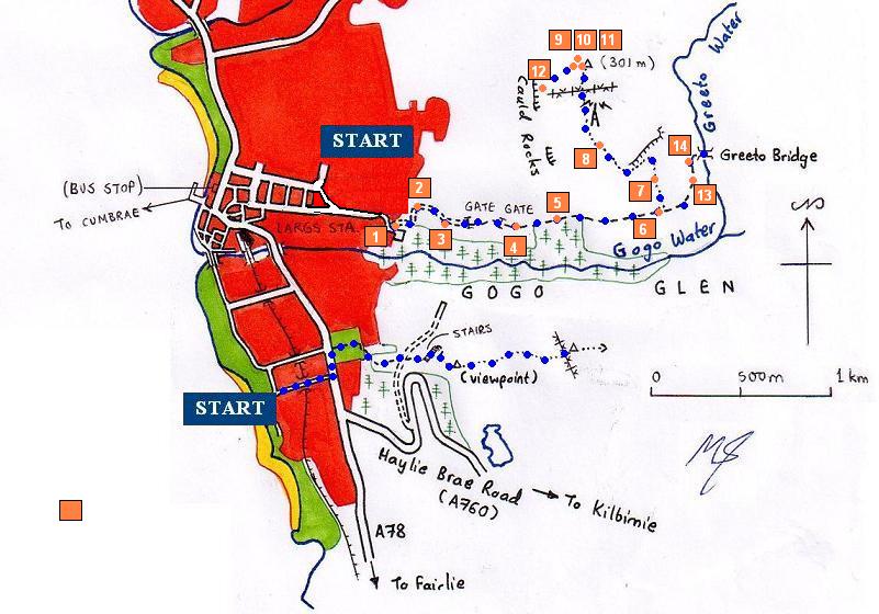
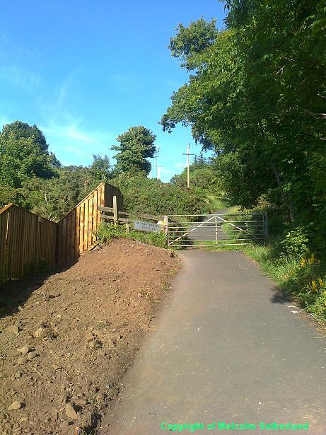
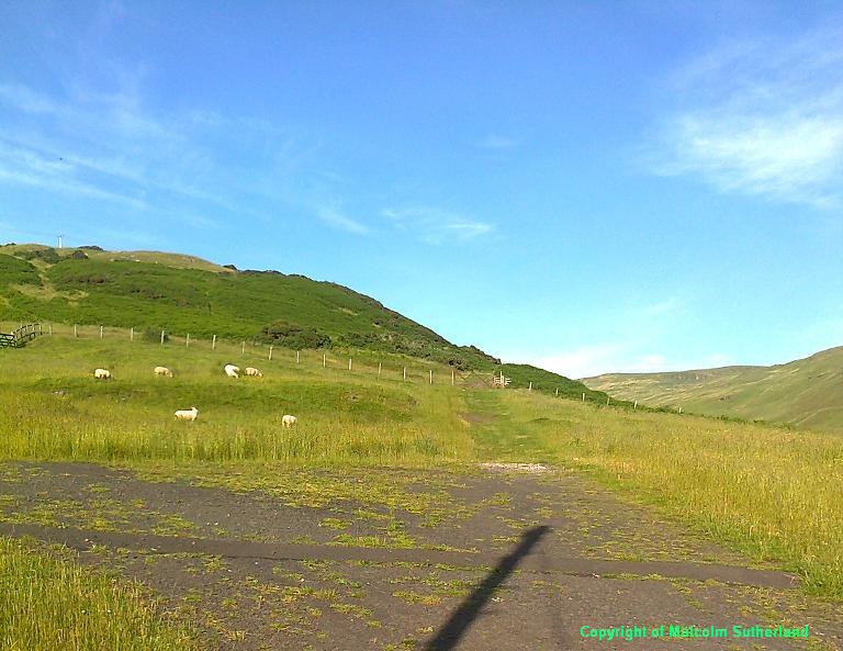
Visitors are advised to approach the Gogo Glen walk by walking through Largs, as the road network can be confusing for the non-local. From the bus stop or railway station, walk towards Gateside Street. Walk to the end of this street, where you'll see a turn-off straight ahead and up past Largs Academy (Flatt Road). Walk along Flatt Road until the bend, where there is a slight turn-off to the right, joining with another road (Bellsdale Avenue). Walk up to the fence and stile on the left side (Photo 1).
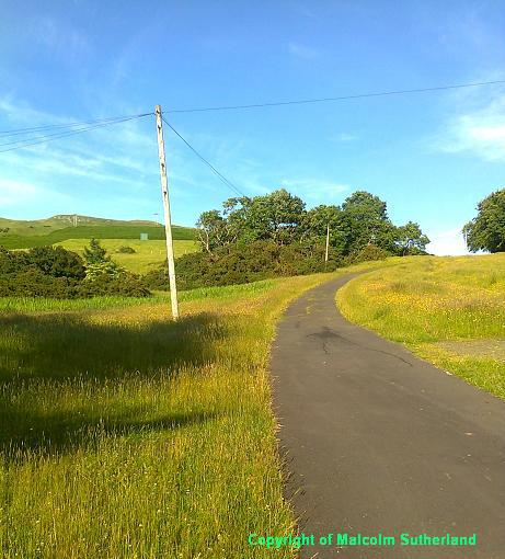
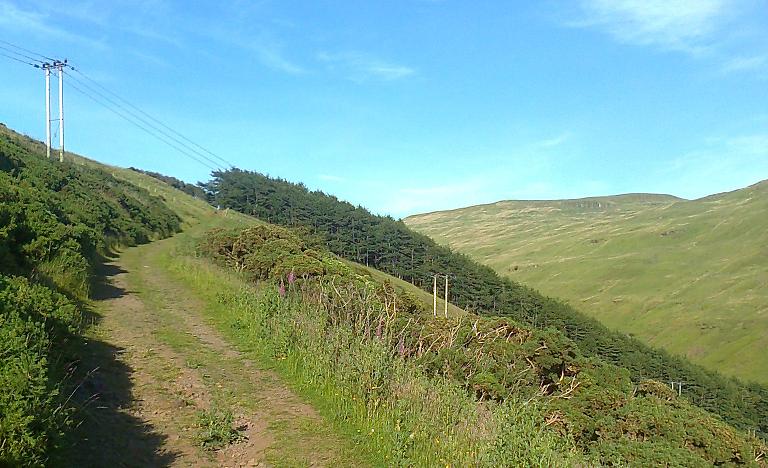
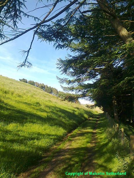
The start of the Gogo Glen path is very steep, and can be very slippery in winter. Fortunately this is covered in tarmac, which runs straight up the hill for a couple of hundred yards (Photo 2) towards a generator box. The path then becomes a loose gravel track (Photo 3), and you shall have to clamber over the stile at two gates. The relentless hill becomes gentler as you approach a woodland (Photo 4), and you pass the highest point along the Gogo Glen track alongside the woodland (Photo 5).
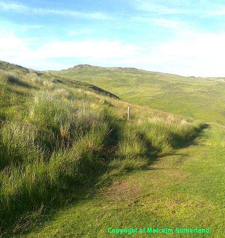
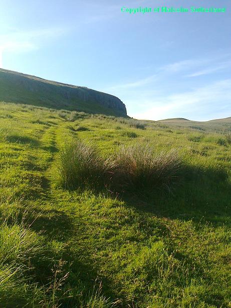
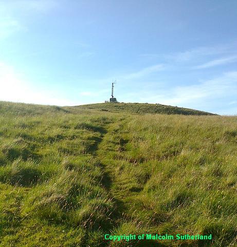
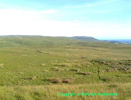
You should encounter the track up the hill a few hundred yards past the woodland (Photo 6). Be careful as you clamber through the thick grass up the steep slope (Photo 7) (I have twice fallen and pulled a muscle on this track). The track turns sharp left below a cliff-face, and up the side towards the plateau. As you clamber onto the plateau, you'll see the mobile phone mast ahead (Photo 8). Walk past the mobile phone mast into the grass, and carefully tread towards the summit of the hill (there is no definite path). You shall have to clamber over a barbed-wire fence halfway to the hill.
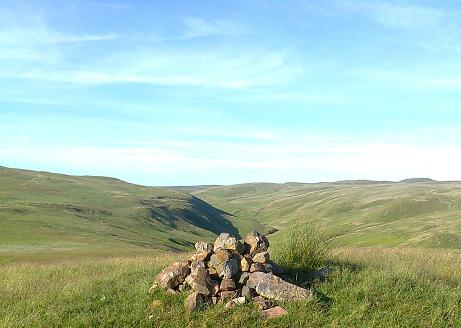
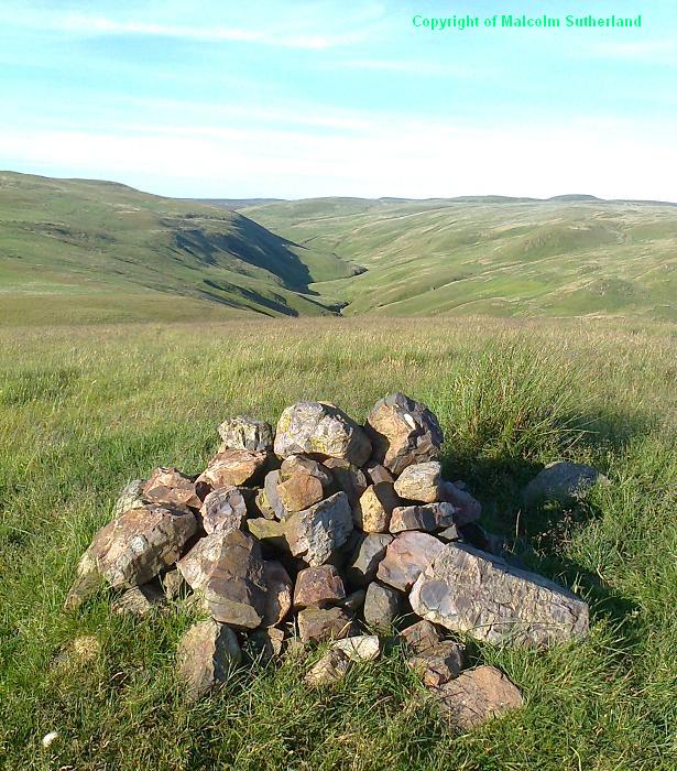
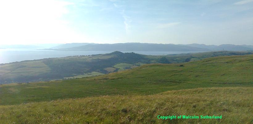
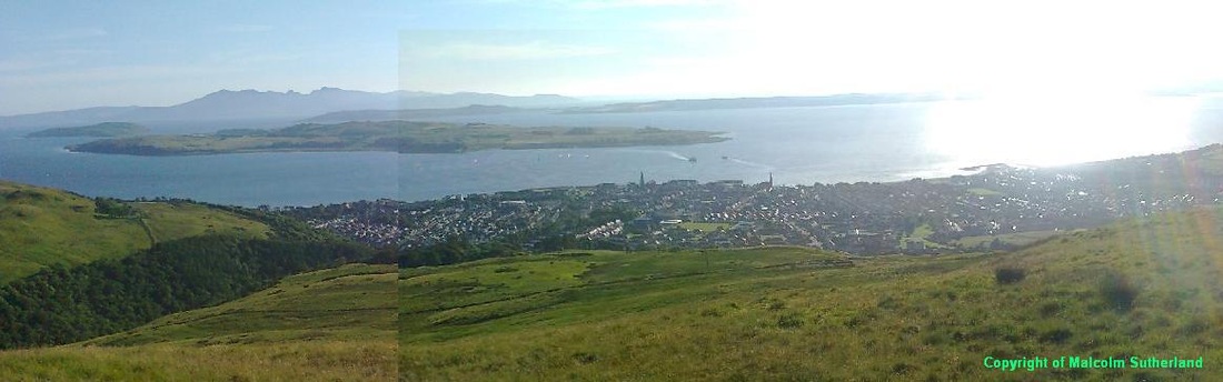
On a good day, you should be rewarded with a pleasing panorama, including the back hills towards Burnt Hill and Hill of Stake (Photo 9); the Cowal Peninsula, Fort Hill and Bute (Photo 10); as well as some of the other back hills to the south (including Kames Hill) (Photo 11). If you carefully walk towards the cliffedge to the west, you should also find an excellent view overlooking Largs (Photo 12).
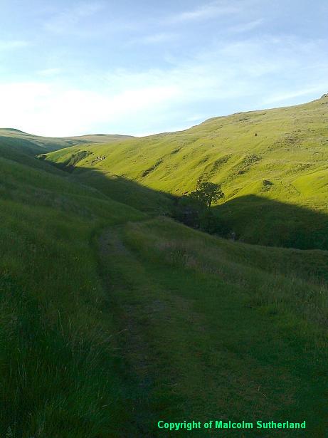
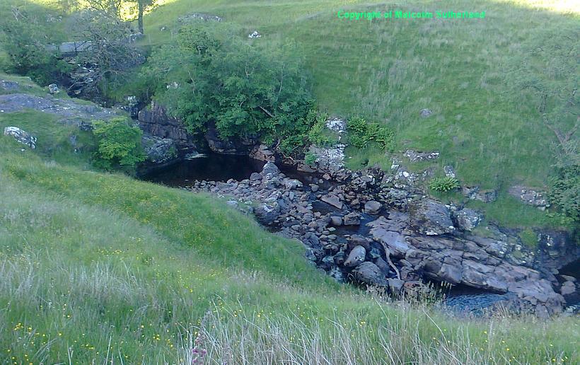
Make your way back down the track towards the Gogo Glen path. To finish off (what in my case has often been an evening's walk), walk along the rest of the Gogo Glen path towards Greeto Bridge (Photos 13 and 14). Less than two miles east of Largs, and already the walker will find him/her-self in remote, rugged wilderness out here.
The start of the Gogo Glen path is very steep, and can be very slippery in winter. Fortunately this is covered in tarmac, which runs straight up the hill for a couple of hundred yards (Photo 2) towards a generator box. The path then becomes a loose gravel track (Photo 3), and you shall have to clamber over the stile at two gates. The relentless hill becomes gentler as you approach a woodland (Photo 4), and you pass the highest point along the Gogo Glen track alongside the woodland (Photo 5).
You should encounter the track up the hill a few hundred yards past the woodland (Photo 6). Be careful as you clamber through the thick grass up the steep slope (Photo 7) (I have twice fallen and pulled a muscle on this track). The track turns sharp left below a cliff-face, and up the side towards the plateau. As you clamber onto the plateau, you'll see the mobile phone mast ahead (Photo 8). Walk past the mobile phone mast into the grass, and carefully tread towards the summit of the hill (there is no definite path). You shall have to clamber over a barbed-wire fence halfway to the hill.
On a good day, you should be rewarded with a pleasing panorama, including the back hills towards Burnt Hill and Hill of Stake (Photo 9); the Cowal Peninsula, Fort Hill and Bute (Photo 10); as well as some of the other back hills to the south (including Kames Hill) (Photo 11). If you carefully walk towards the cliffedge to the west, you should also find an excellent view overlooking Largs (Photo 12).
Make your way back down the track towards the Gogo Glen path. To finish off (what in my case has often been an evening's walk), walk along the rest of the Gogo Glen path towards Greeto Bridge (Photos 13 and 14). Less than two miles east of Largs, and already the walker will find him/her-self in remote, rugged wilderness out here.
All text, maps and imagery are copyright of Dr Malcolm Sutherland (2013 - 14).
DISCLAIMER: visitors to this website must take all necessary precautions when travelling to the sites listed in this website and when walking. People viewing this website are entirely responsible for their own transportation, health and safety if they travel to relevant locations and attempt any of the walks listed on this website.
DISCLAIMER: visitors to this website must take all necessary precautions when travelling to the sites listed in this website and when walking. People viewing this website are entirely responsible for their own transportation, health and safety if they travel to relevant locations and attempt any of the walks listed on this website.
